Description
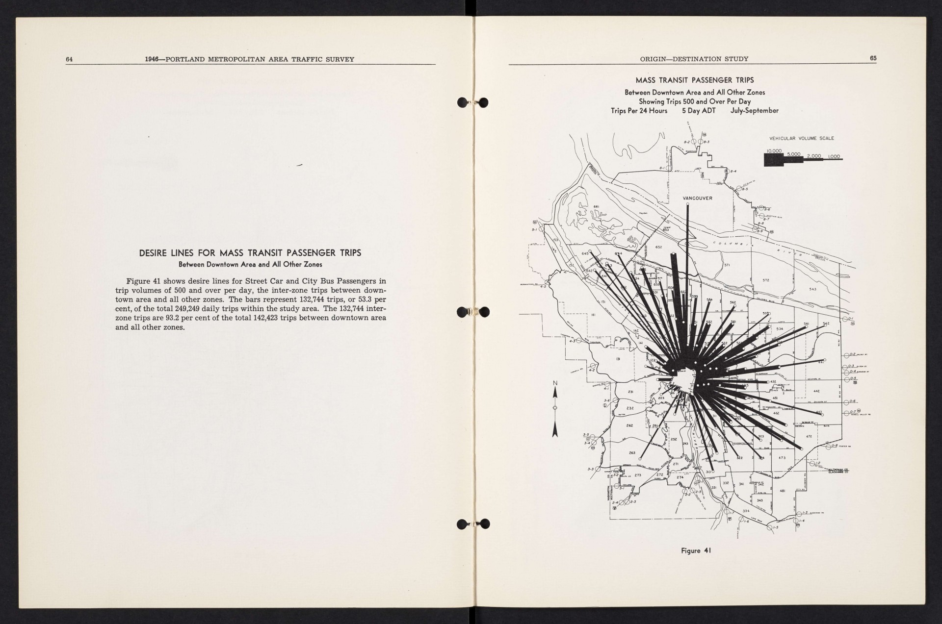
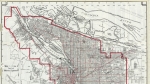
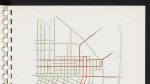
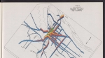
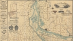
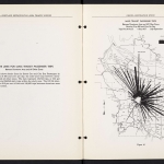
Map from a 1946 report, showing the volume of mass transit trips between downtown Portland and other points around the metropolitan area. Thicker lines indicate more daily mass transit trips. The map shows numerous desire lines crossing the Willamette River, between downtown and the east side, where there were a greater number of bus and street car lines. A very thick line, indicating 5,000 daily transit trips, stretches between the city of Vanport on the Columbia River and downtown Portland.
Download Files
Related content

Collections with this item
Details
Transcription
Contributors
Digital Publisher
Subject.Topic
Subject.Place
Language
Rights & Usage
Rights undetermined (the copyright and related rights status of this work is unknown).
Identifier
- XXmap_000082
Type
Date.Range
Format.Original
File format
Shelf.Location
- OREGON 625.7 O67po 1946
Add new comment