Description
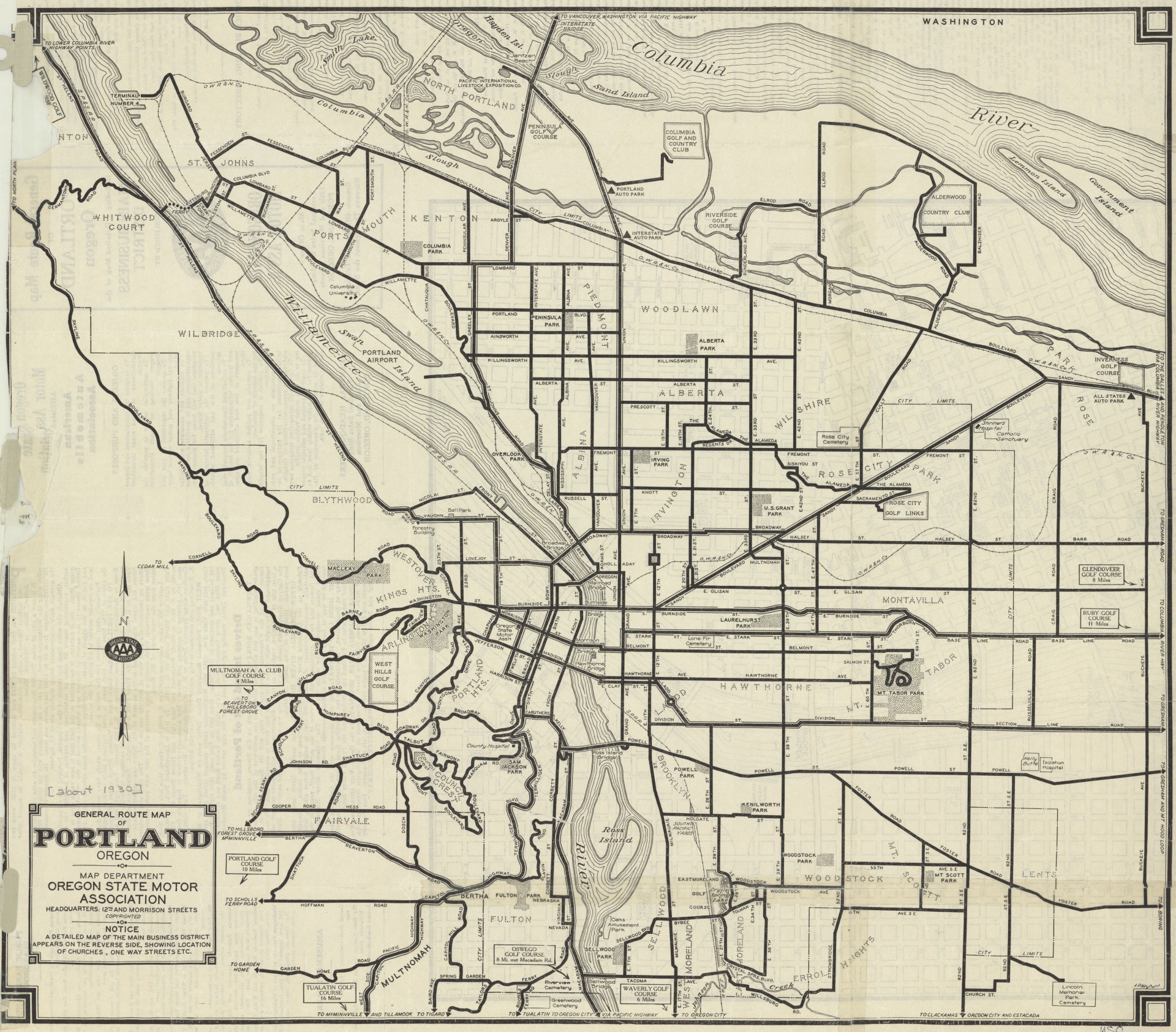
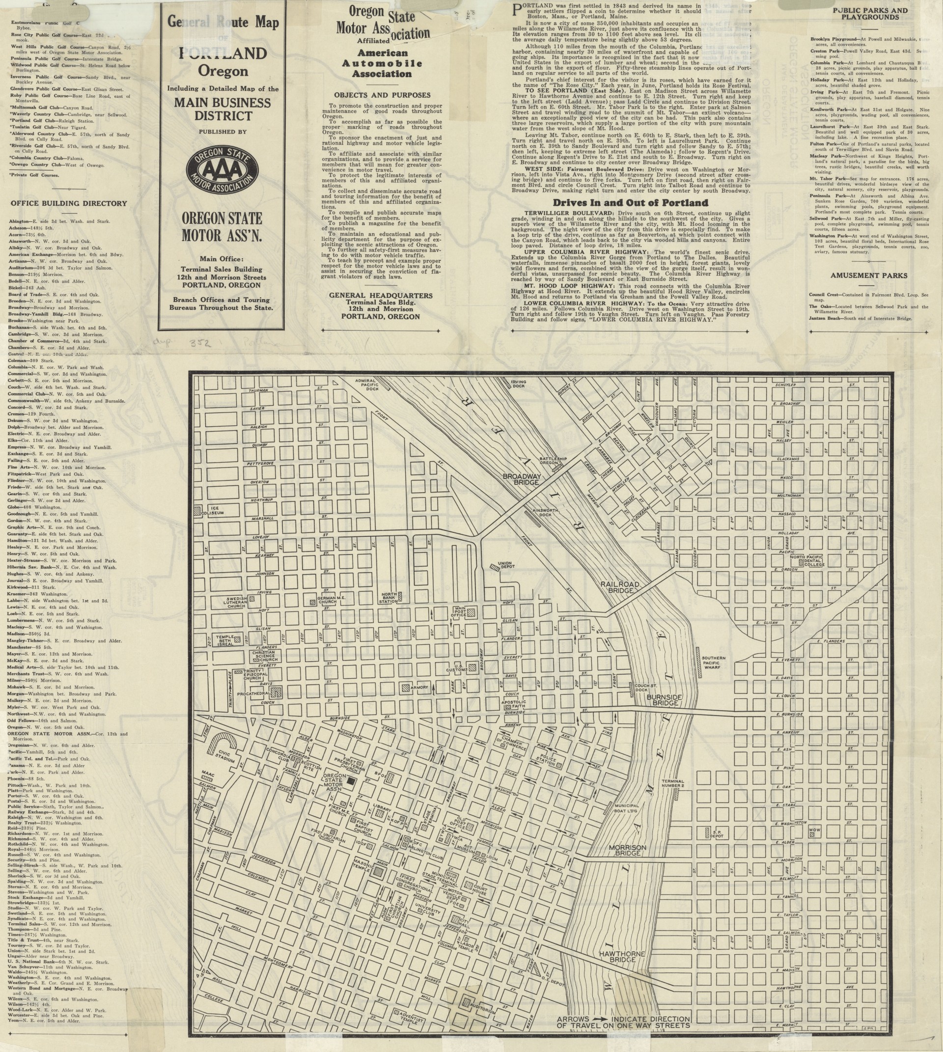
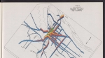
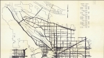
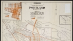
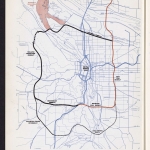
Street map showing arterial streets for automobile traffic in and around the city of Portland. City limits are marked on the map, and selected neighborhood names are noted. On the reverse side, there is a larger scale map showing downtown Portland's business district. The map lists golf courses, office buildings, public parks and playgrounds, and amusement parks; auto parks are noted with a triangle symbol. The front of the map has a hand-written date, 1930, presumably added by library staff.
Download Files
Related content

Collections with this item
Details
Extent
- 2 pages
Digital Publisher
Subject.Topic
Subject.Place
Language
Rights & Usage
Rights undetermined (the copyright and related rights status of this work is unknown).
Identifier
- XXmap_000157
Add new comment