Description
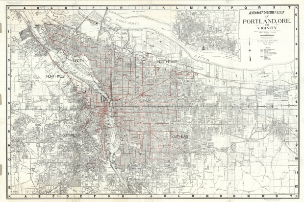
Map of the Portland area, dated 1959. Includes Portland, Fairview, Wood Village, Gresham, Beaverton, and Vancouver, Washington. Bus routes are prominently featured on the map. Inside Portland city limits, gas-powered and electric trolley buses are differentiated. Bus lines outside city limits are shown as well. The reverse side of the map has two inset maps: one is a detailed map of downtown Portland with the names of businesses and public buildings; the other is a map of the Portland Scenic Drive.
Download Files
Collections with this item
Details
Extent
- 2 images
Contributors
Digital Publisher
Subject.Topic
Subject.Place
Language
Rights & Usage
In copyright. Used by permission of the copyright holder, who retains publication rights thereto. Use of resources from this collection beyond the exceptions provided for in the Fair Use and Educational Use clauses of the U.S. Copyright Law may violate federal law.
Identifier
- JWmap_000016


Add new comment