Description
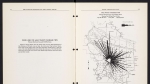
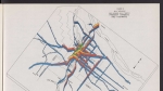
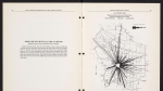
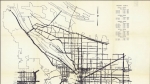
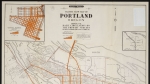
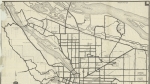
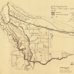
Map for bicyclists, dated May, 1896, showing good, fair and poor cycling roads in the Portland area. The area covered is large: the city of St. Helens in the north, Cornelius to the west, Oregon City to the south, and Camas, Washington to the east. Circles on the map mark the distance in miles from downtown Portland. The left side of the map is a series of advertisements for local businesses, including bicycle shops and hotels. The map is marked Adopted by the Multnomah Wheelmen, and shows that organization's winged M logo. Visit City of Portland Archives for more information at https://efiles.portlandoregon.gov/Record/10222795.
Related content

Collections with this item
Details
Creator
Contributors
Digital Publisher
Subject.Topic
Subject.Place
Language
Rights & Usage
Public domain (this work is believed to be free of known restrictions under copyright law).
Identifier
- PUmap_000001
Type
Date.Range
Format.Original
File format
Shelf.Location
- A2010-015, M/4090
Add new comment