Description
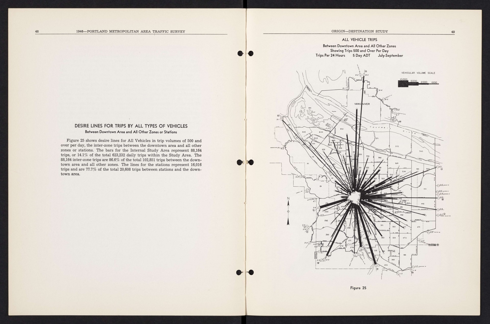
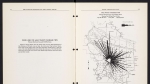
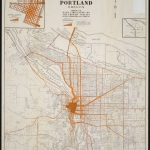
Map showing average daily vehicle trips between downtown Portland and other points, July-September 1946. The thickest lines indicate the most traffic. The three largest lines visible describe traffic west to Scholls Ferry Rd. and south to Macadam Rd. and Hwy. 99-E. The map also shows a medium-weight line to the city of Vanport (which is not named on the map), just south of Hayden Island on the Columbia River.
Download Files
Related content


Collections with this item
Details
Transcription
Contributors
Digital Publisher
Subject.Topic
Subject.Place
Language
Rights & Usage
Rights undetermined (the copyright and related rights status of this work is unknown).
Identifier
- XXmap_000081
Type
Date.Range
Format.Original
File format
Shelf.Location
- OREGON 625.7 O67po 1946
Add new comment