Description
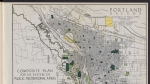
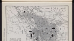
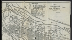
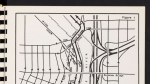
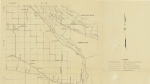
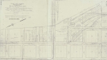
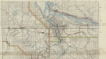
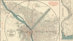
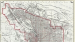
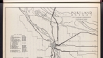
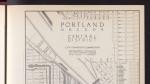
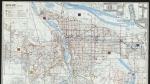
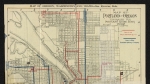
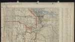
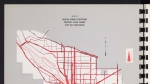
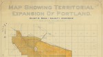
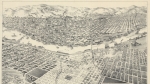
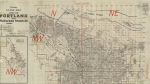
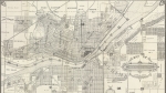
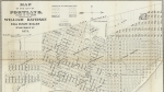
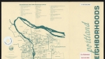
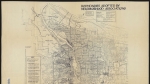
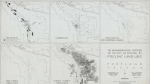
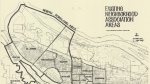
Detailed city map of Portland, dated 1915. Street names; city limits; township, range and section; and parks are noted. Willamette and Columbia river bridges and ferries are labelled. Many railroad lines are also marked on the map. An inset map and accompanying text explain Portland's somewhat complicated street numbering system of the era. A small car line diagram inset shows streetcar lines through the city; a set of loop diagrams illustrate the routes each streetcar line took through downtown Portland. Visit City of Portland Archives for more https://efiles.portlandoregon.gov/record/13249029
Related content


Collections with this item
Details
Creator
Contributors
Digital Publisher
Subject.Topic
Subject.Place
Language
Rights & Usage
Public domain (this work is believed to be free of known restrictions under copyright law).
Identifier
- PUmap_000031
Type
Date.Range
Format.Original
File format
Shelf.Location
- M/4377
Comments
Historic Oregon Maps
Where in the Central Library of Multnomah County would I find historic maps of the State of Oregon, and the Cities of Portland, Salem, Albany, Eugene, and others?
Historic maps
Hello Jason,
We have a variety of historic maps at our Central Library and online. The best way to find what you need is to contact us directly with specifics about what you are trying to find and we can create a list of specific maps to meet your needs.
Thank you for asking this question
Erica
Technical Services – Multnomah County Library
https://multcolib.org/contact-us – 503.988.5123
Add new comment