Description
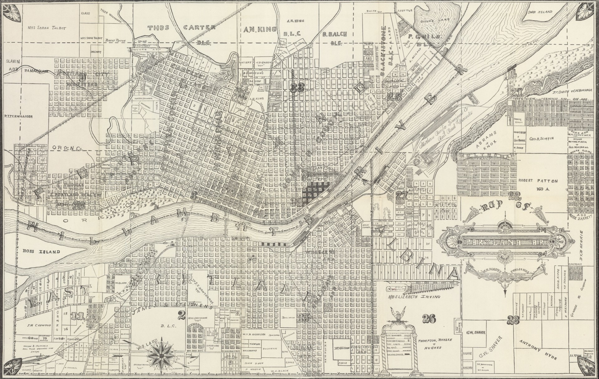
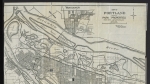
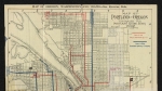
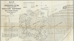
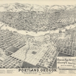
Map of the cities of Portland, East Portland and Albina, compiled January 1886, showing street names, city limits, the names of owners of some large plots of land, Donation Land Claim names and section numbers. The Willamette River from Ross Island to Swan Island is also on the map, as are Guild's Lake, Tanner Creek and several unnamed creeks. Four ferry lines cross the Willamette River at Jefferson St., Stark St., and Albina. An unnamed ferry connects the railroad yards on the east and west sides of the river. Several streetcar lines, railroad lines and rail yards appear on the map. Some are labelled: Oregon Railway and Navigation Co., Willamette Valley Railroad, Northern Pacific Railroad and Oregon and California Railroad.
Download Files

Related content


Collections with this item
Details
Creator
Digital Publisher
Subject.Topic
Language
Rights & Usage
Public domain (this work is believed to be free of known restrictions under copyright law).
Identifier
- JWmap_000003
Type
Date.Range
Format.Original
File format
Shelf.Location
- W 912.79549 M393
Add new comment