Description
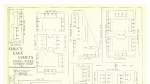
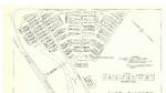
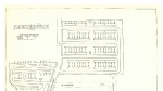
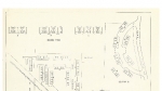
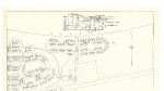
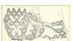
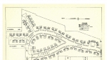
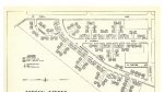
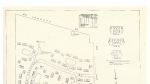
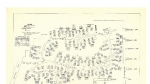
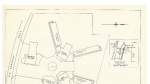
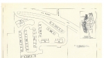
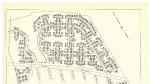
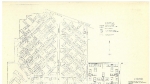
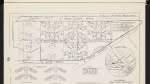
Map of Park Side Homes, published around 1943, from a collection of maps of temporary housing projects administered by Housing Authority of Portland during the Second World War. The map shows street names, house and unit numbers, and a community building. An arrow points east to Pier Park. When Park Side Homes was demolished after the Second World War, the street grid was redesigned, and N Burgard St. was renamed N Lombard St. Visit City of Portland Archives for more https://efiles.portlandoregon.gov/Record/2298788/ and https://efiles.portlandoregon.gov/record/10936940
Related content
Collections with this item
Details
Contributors
Digital Publisher
Subject.Topic
Subject.Place
Language
Rights & Usage
Rights undetermined (the copyright and related rights status of this work is unknown).
Identifier
- PUmap_00036
Type
Date.Range
Format.Original
File format
Shelf.Location
- AD/6492, M/1117
Add new comment