Description
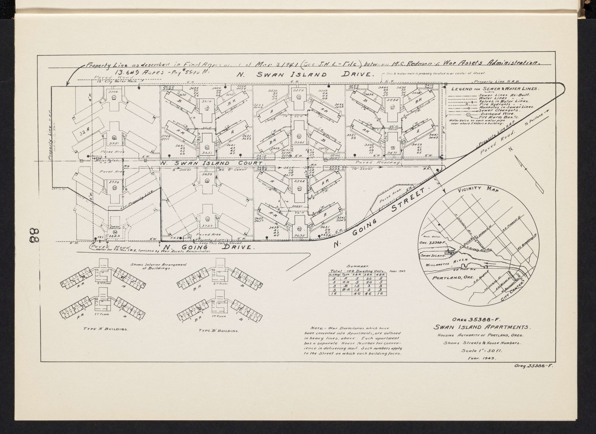
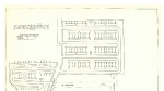
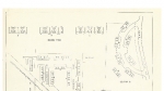
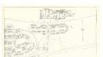
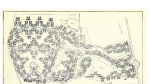
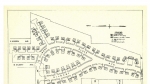
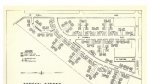
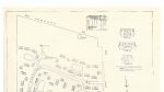
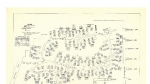
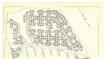
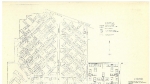
Map of Swan Island Apartments, from a June 1949 report about the disposal of temporary housing after the close of the Second World War. The map shows street names, house numbers and a community building. The housing project was built on Swan Island. The part of N Going St. that shows on this map has been renamed N Channel Ave; most of the other streets on the map no longer exist. The buildings were originally constructed as dormitories for war workers. Each pair of buildings had a central service building connecting it, with a heating plant, showers and lounge. In 1949, several of the dormitory buildings were converted to apartments to house families displaced by the 1948 Vanport Flood. The Swan Island Dormitories/Apartments were demolished in the 1950s.
Download Files
Related content
Collections with this item
Details
Transcription
Digital Publisher
Subject.Topic
Subject.Place
Language
Rights & Usage
Rights undetermined (the copyright and related rights status of this work is unknown).
Identifier
- XXmap_000164
Type
Date.Range
Format.Original
File format
Shelf.Location
- OREGON 331.83 P836
Add new comment