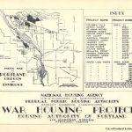
Description
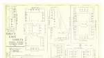
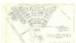
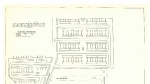
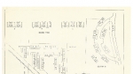
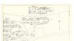
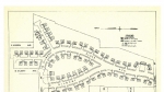
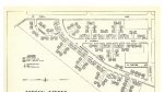
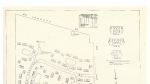
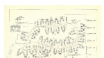
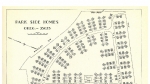
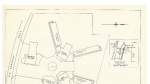
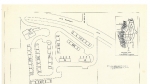
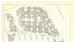
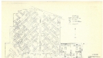
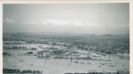
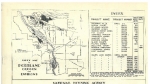
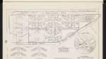
Map of the city of Vanport, published around 1943, from a collection of maps of temporary housing projects administered by Housing Authority of Portland during the Second World War. Map shows street names as well as house and apartment numbers. Also featured are the locations of schools, nursery schools, fire stations, ice houses, shopping centers, bus stations, recreational facilities, a hospital, a library, a police station, and more. Visit City of Portland Archives for more https://efiles.portlandoregon.gov/Record/2298788/ and https://efiles.portlandoregon.gov/record/10936940
Related content
Collections with this item
Details
Contributors
Digital Publisher
Subject.Topic
Subject.Place
Language
Rights & Usage
Rights undetermined (the copyright and related rights status of this work is unknown).
Identifier
- PUmap_000041
Type
Date.Range
Format.Original
File format
Shelf.Location
- AD/6492, M/1117
Add new comment