Description
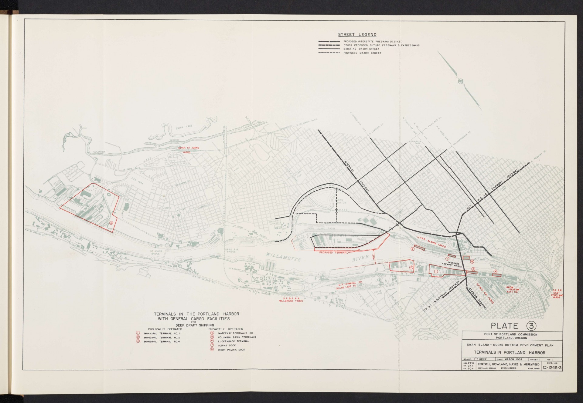
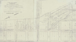
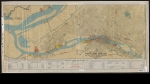
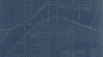
Map of deep draft shipping terminals in the lower Willamette River, dated March 1957. In addition to existing public and private terminals, a proposed terminal is shown on Swan Island. The map features surface transportation infrastructure that connects to port facilities. Several proposed freeways are indicated: the U.S. 30 Industrial Freeway, the Stadium Freeway, the Alt. U.S. 30 Fremont Freeway and the Burrage Freeway. A proposed site for the Fremont Bridge is also on the map.
Download Files
Related content
Collections with this item

Details
Transcription
Contributors
Digital Publisher
Subject.Topic
Subject.Place
Language
Rights & Usage
Rights undetermined (the copyright and related rights status of this work is unknown).
Identifier
- XXmap_000086
Type
Date.Range
Format.Original
File format
Shelf.Location
- OREGON 710 C81d
Add new comment