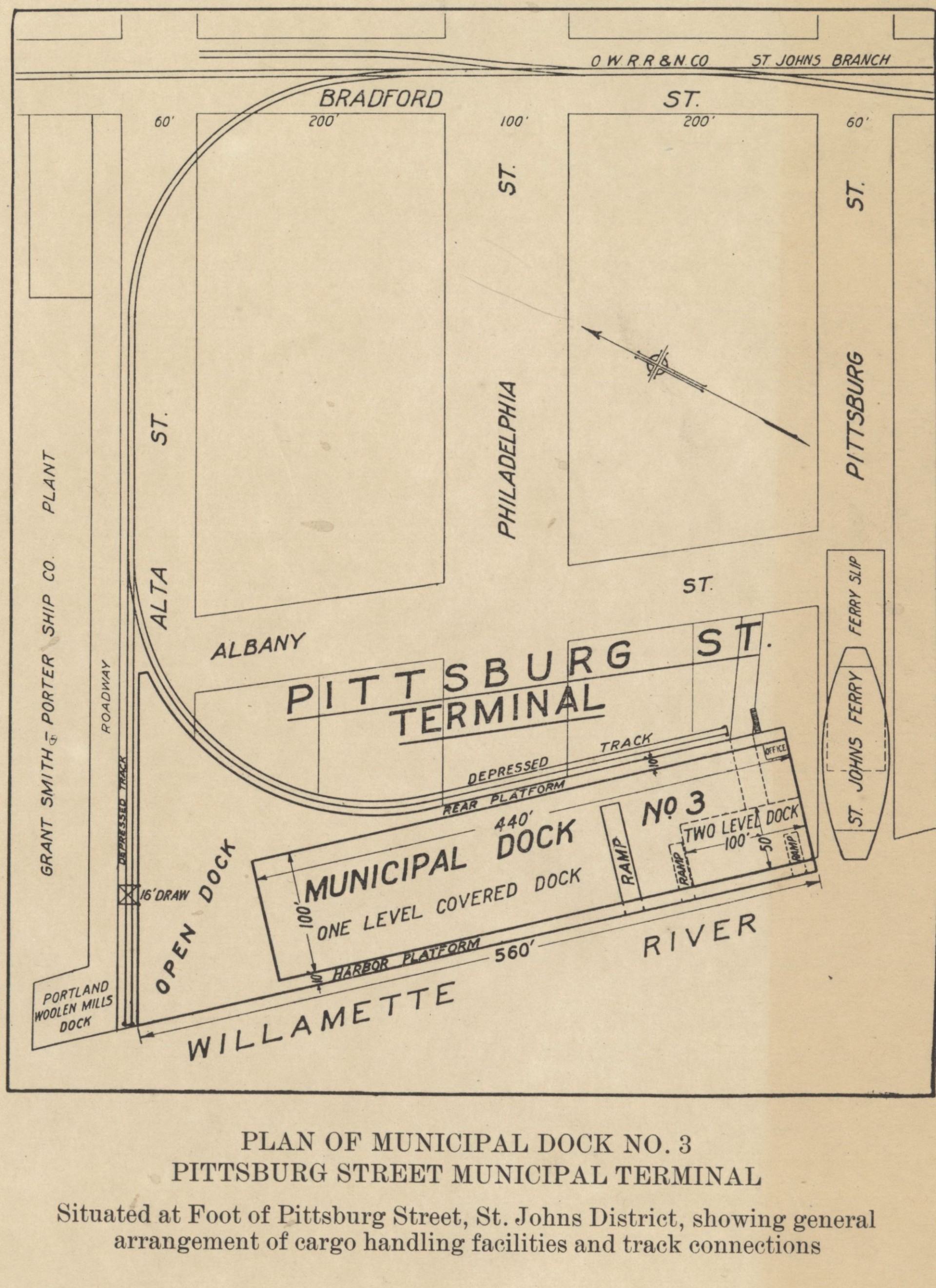
Description
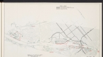
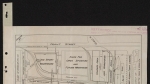
Undated, detailed plan of Municipal Dock No. 3, located on the east side of the Willamette River in the St. Johns neighborhood. The dock runs along Albany St. between Pittsburgh and Alta Streets. It shows ship berths, an industrial plant, and the Oregon Washington Railroad & Navigation Company's tracks. The plan also shows the location of the east side landing of the St. Johns Ferry. The dock was originally named St. Johns Dock; this plan was likely published sometime after 1915, when the name was changed to Municipal Dock No. 3.
Download Files
Related content


Collections with this item

Details
Digital Publisher
Subject.Topic
Subject.Place
Language
Rights & Usage
Rights undetermined (the copyright and related rights status of this work is unknown).
Identifier
- JWmap_000012
Add new comment