Description
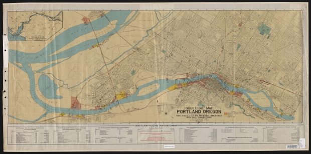
Map of Willamette River port facilities in Portland, dated 1919. Docks, dry docks, shipbuilding companies, lumber mills and other harborside industries are described on the map. Rail lines and facilities, city streetcars and interurban lines are shown in detail. Streetcar lines are drawn in green. Ferries are marked at Sellwood, upper Albina and St. Johns. Six Willamette River bridges in Portland, and two Columbia River bridges to Vancouver are shown. All eight are drawbridges, and the map details each bridge's clearance height and span opening width. An inset map shows the ship channel of the Columbia and Willamette rivers from the ocean to Portland.
Download Files
Collections with this item
Details
Transcription
Contributors
Digital Publisher
Subject.Topic
Subject.Place
Language
Rights & Usage
Public domain (this work is believed to be free of known restrictions under copyright law).
Identifier
- XXmap_000073
Type
Date.Range
Format.Original
File format
Shelf.Location
- OREGON MAP 627.3 P85Ppi 1919


Add new comment