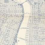
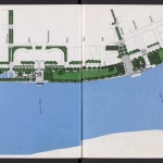
Description
Map of part of Waterfront Park, dated November 20, 1982. The map shows the area of the park that stretches from the Hawthorne Bridge to the Morrison Bridge. Irrigation, water, sewer and electrical utilities are noted. Mill Ends Park, known as the World's Smallest Park, is shown at the intersection of SW Taylor and SW Front Ave. (now SW Naito Parkway). Visit City of Portland Archives for more https://efiles.portlandoregon.gov/record/17399
Collections with this item
Details
Contributors
Digital Publisher
Subject.Topic
Subject.Place
Language
Rights & Usage
Rights undetermined (the copyright and related rights status of this work is unknown).
Identifier
- PUmap_000023
Type
Date.Created
November 20, 1982
Date.Range
Format.Original
File format
Shelf.Location
- A2013-007, M/11080


Add new comment