Description
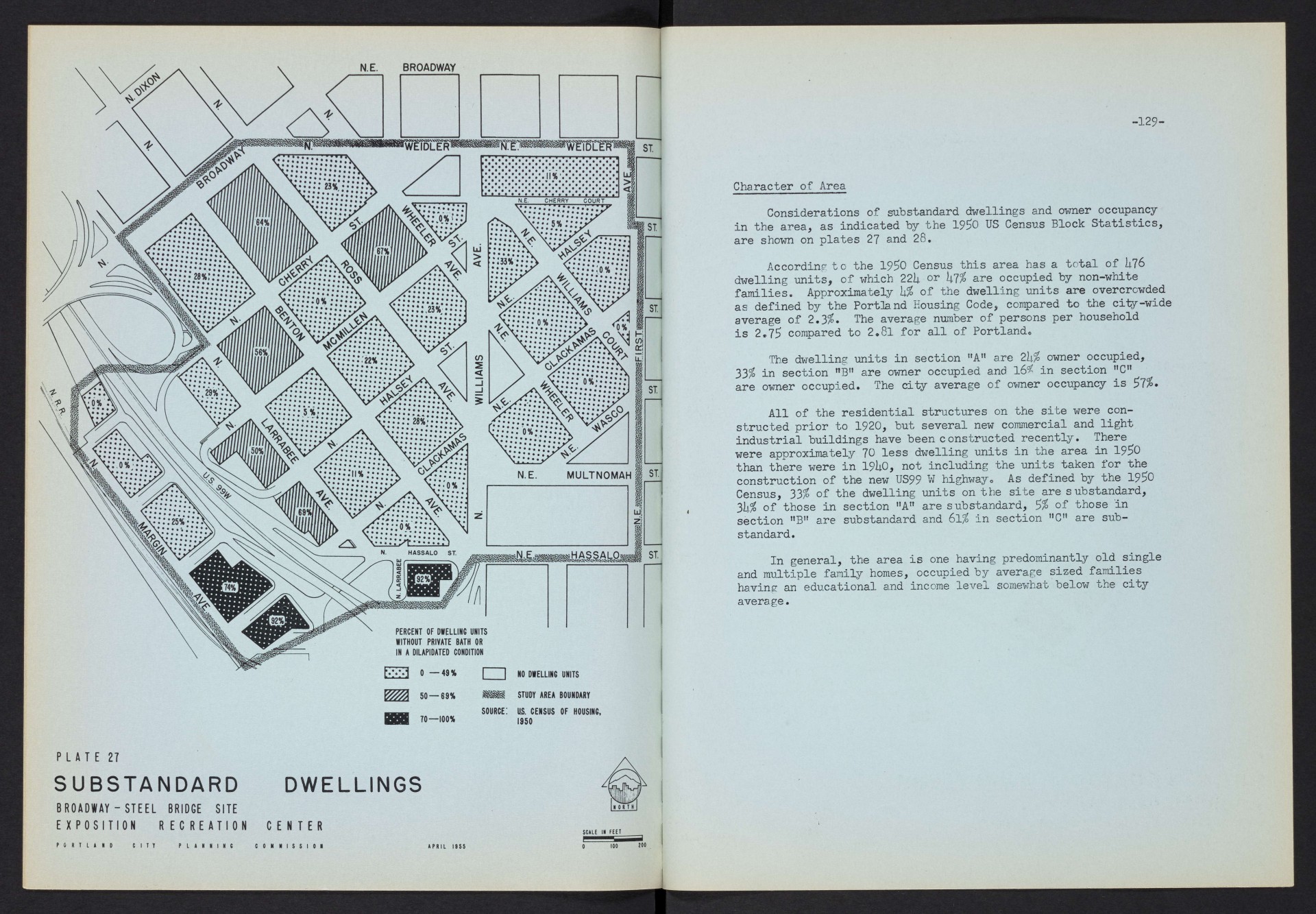
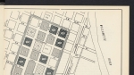
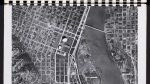
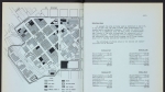
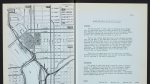
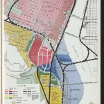
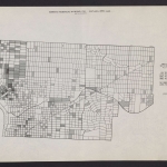
Map of the area near the east ends of the Steel and Broadway bridges, dated April 1955. This is the site that was eventually chosen for the Exposition-Recreation Center, now known as the Veterans Memorial Coliseum. The map shows the percentage of dwelling units on each block that lacked a private bath or that the city judged to be in a dilapidated condition. During the planning process for the Exposition-Recreation Center, the Portland Housing Authority used the condition of neighborhoods as a rationale for redevelopment, and to gain access to federal urban renewal funding. The text accompanying the map provides additional details about the neighborhood, including race, owner occupancy and overcrowding. Ultimately, more than 200 African American families, a sizeable part of the city's Black population, were displaced by the development.
Download Files
Related content

Collections with this item
Details
Transcription
Contributors
Digital Publisher
Subject.Topic
Subject.Place
Language
Rights & Usage
Rights undetermined (the copyright and related rights status of this work is unknown).
Identifier
- XXmap_000092
Type
Date.Range
Format.Original
File format
Shelf.Location
- OREGON 711 P83si
Add new comment