Description
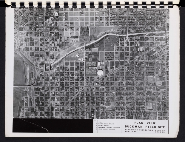
Aerial photograph from a 1956 report, altered to show a proposed exposition and recreation center, including parking and highway access, in the Buckman neighborhood in SE Portland. The altered portion of the map is along SE 12th Ave., south of the Banfield Freeway (I-84). The city eventually built the Exposition-Recreation Center (now called the Veterans Memorial Coliseum) near the east end of the Broadway Bridge.
Download Files
Collections with this item
Details
Transcription
Contributors
Digital Publisher
Subject.Topic
Subject.Place
Language
Rights & Usage
Rights undetermined (the copyright and related rights status of this work is unknown).
Identifier
- XXmap_000095
Type
Date.Range
Format.Original
File format
Shelf.Location
- OREGON 711 S62a


Add new comment