Description
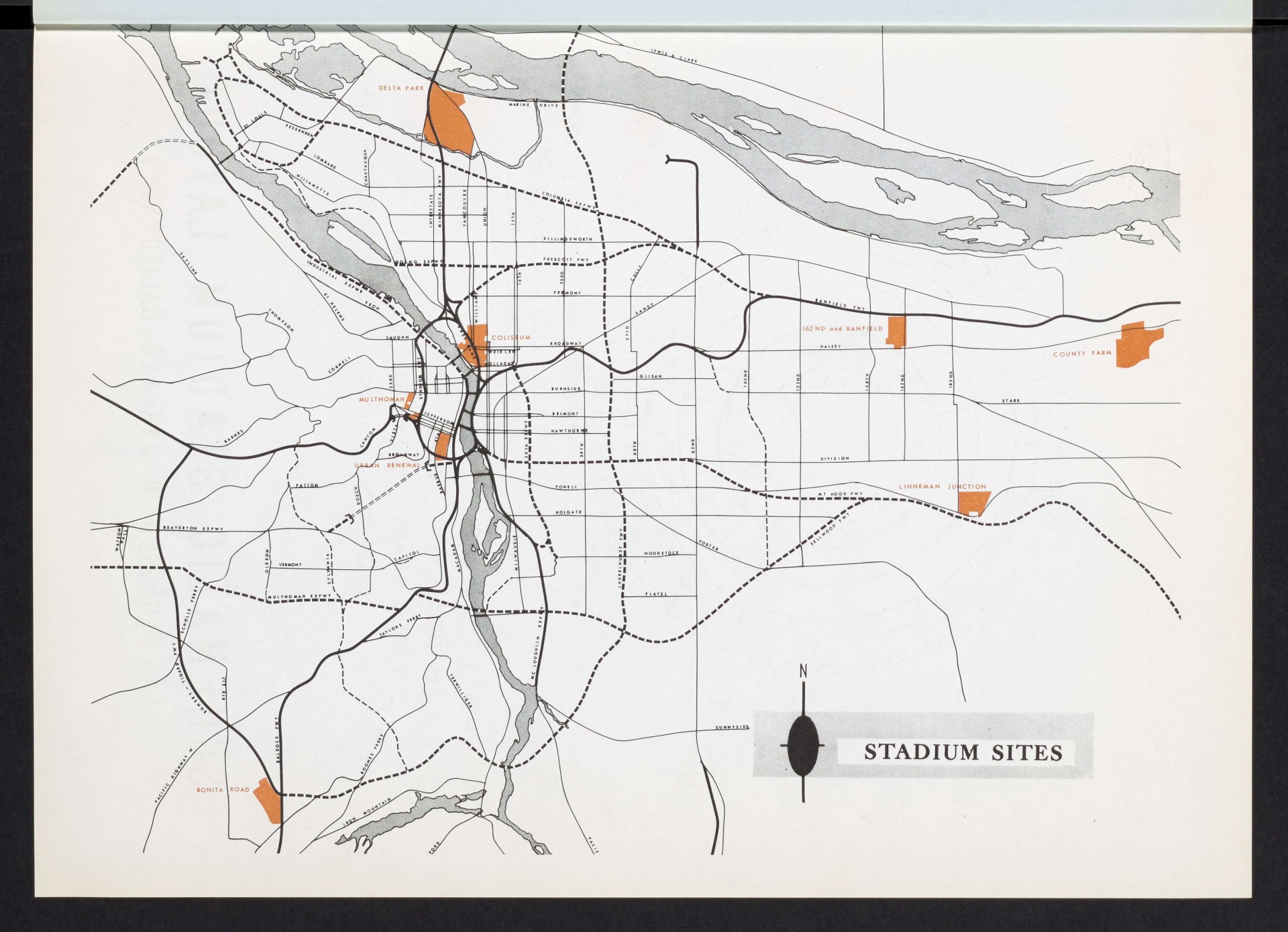
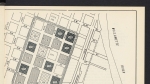
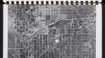
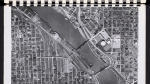
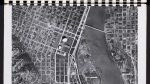
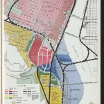
Map from a 1962 report showing proposed sites for a new sports stadium: Delta Park in North Portland, the Memorial Coliseum (which had just been completed, in 1960), 162nd and Banfield, the Multnomah County Farm (now McMenamin's Edgefield, in Troutdale), Lineman Junction (at SE 182nd and Powell), the South Auditorium District urban renewal area, Bonita Rd. (in Tigard), and the existing Multnomah Stadium (later known as Civic Stadium, Portland General Electric (PGE) Park, Jeld-Wen Field and Providence Park). The map also shows highways and major streets that would provide access to each stadium site. This includes many planned freeways such as the Laurelhurst Freeway and the Mount Hood Freeway, neither of which were ultimately built.
Download Files
Related content

Collections with this item
Details
Contributors
Digital Publisher
Subject.Topic
Subject.Place
Language
Rights & Usage
Rights undetermined (the copyright and related rights status of this work is unknown).
Identifier
- XXmap_000149
Type
Date.Range
Format.Original
File format
Shelf.Location
- OREGON 711 P83st
Add new comment