Description
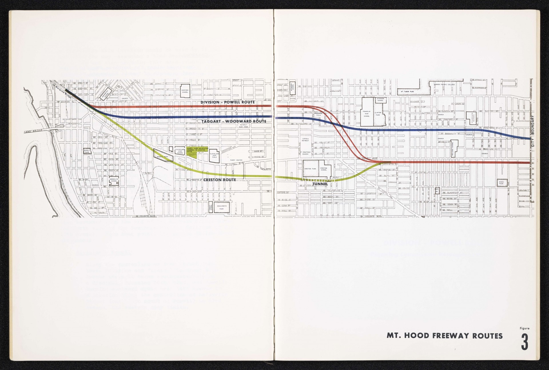
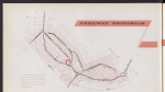
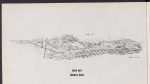
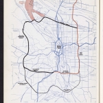
Map from a 1965 Portland City Planning Commission report advocating for the building of the Mt. Hood Freeway. This map shows three proposed routes along Division and Powell streets, along Taggart and Woodward streets, or through the Creston neighborhood. The Creston Route includes a planned tunnel under the hill just south of Creston Park and Creston School. The Creston route shows a tunnel south of Creston Park, and would require relocating Powell Park to a spot just east of Cleveland High School. The proposed Mt. Hood Freeway was never built.
Download Files
Related content


Collections with this item
Details
Transcription
Extent
- 2 pages
Contributors
Digital Publisher
Subject.Topic
Subject.Place
Language
Rights & Usage
Rights undetermined (the copyright and related rights status of this work is unknown).
Identifier
- XXmap_000124
Type
Date.Range
Format.Original
File format
Shelf.Location
- OREGON 388.1 P85m
Add new comment