Description
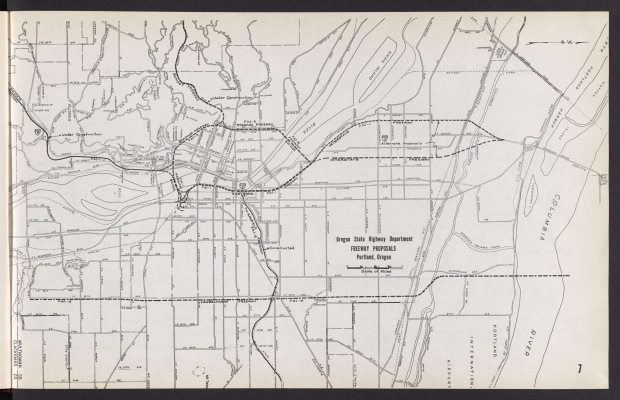
1958 map showing proposed freeways in central Portland. The Banfield Freeway (I-84) and parts of the Sunset Freeway (Hwy. 26) and I-5 are marked completed or under construction. (The southern stretch of I-5 is named the Baldock Freeway and the I-405 bypass is the Stadium Freeway; these names are shown on the map.) The map shows two routes for I-5 running through North Portland: one along N. Delaware Ave.; and one along N. Minnesota Ave. The Minnesota route prevailed and I-5 was built there in the early 1960's. The map also shows a proposed Laurelhurst Freeway along SE and NE 39th Ave. (now called César E. Chávez Blvd.). The Laurelhurst Freeway was never built.
Download Files
Collections with this item
Details
Transcription
Contributors
Digital Publisher
Subject.Topic
Subject.Place
Language
Rights & Usage
Rights undetermined (the copyright and related rights status of this work is unknown).
Identifier
- XXmap_000127
Type
Date.Range
Format.Original
File format
Shelf.Location
- OREGON 625.7 O67in 1958


Add new comment