Description
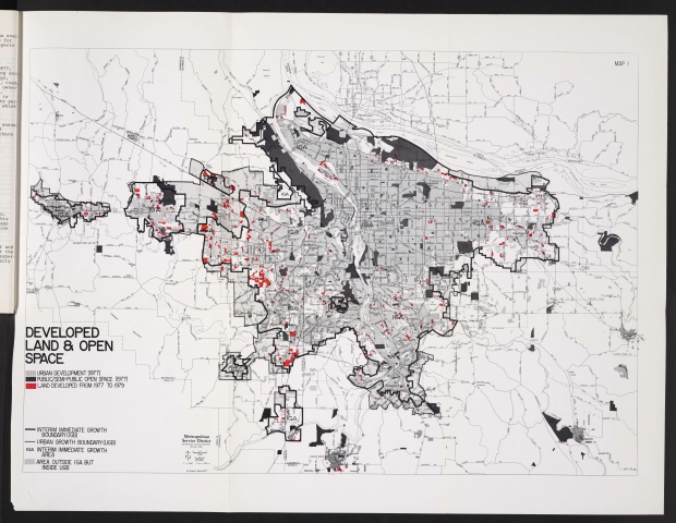
Map from a November 1979 report about the Portland area's urban growth boundary. The map shows urban development and open spaces, with areas developed between 1977 and 1979 highlighted.
Download Files
Collections with this item
Details
Contributors
Digital Publisher
Subject.Topic
Subject.Place
Language
Rights & Usage
Rights undetermined (the copyright and related rights status of this work is unknown).
Identifier
- XXmap_000103
Type
Date.Range
Format.Original
File format
Shelf.Location
- OREGON 333.77 U72


Add new comment