Description
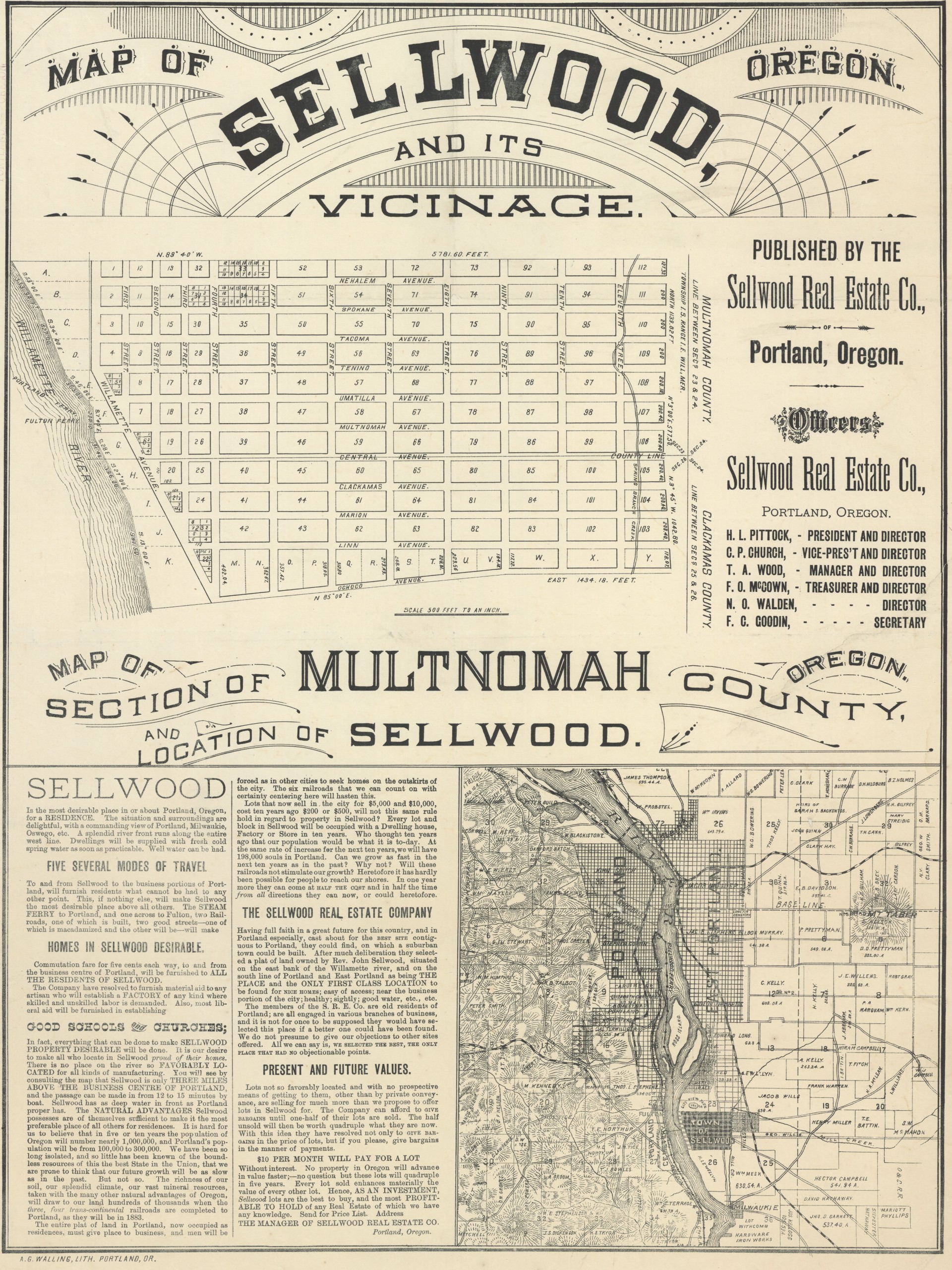
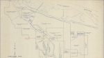
Undated map of the town of Sellwood, produced after the town was platted in 1882, but before the completion of the transcontinental railroad in 1883. Central Ave. is the border between sections 23 and 26 of T1S R1E, and also the county line between Multnomah and Clackamas counties. The county line was later moved south to Ochoco St., shown on this map as the southern boundary of the town of Sellwood. Central Ave. was later renamed SE Sherrett. Spring Branch Creek, now called Crystal Springs Creek, is shown on the map near the eastern border of Sellwood. The Willamette River forms the western border of the town, and two ferry lines are marked: the Portland Ferry and the Fulton Ferry. An inset map shows Sellwood's position in the region, and includes roads, ferry lines, parks and names of landowners.
Download Files
Related content
Collections with this item
Details
Contributors
Digital Publisher
Subject.Topic
Subject.Place
Language
Rights & Usage
Public domain (this work is believed to be free of known restrictions under copyright law).
Identifier
- JWmap_000005
Type
Date.Range
Format.Original
File format
Shelf.Location
- OREGON 912.7954 P852
Add new comment