Description
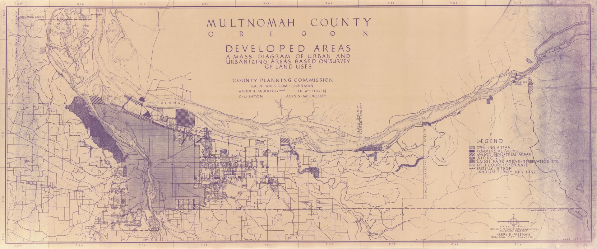
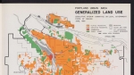
Land use map dated July 1952, showing urban and urbanizing areas in the western half of Multnomah County. The map is shaded to show various uses of land in and around the developing communities of Portland, Gresham, Troutdale, Fairview, Wood Village and Maywood Park. Portland's Forest Park can be seen on the western side of the city. Also notable is the large number of small airports.
Download Files
Related content
Collections with this item

Details
Digital Publisher
Subject.Topic
Subject.Place
Language
Rights & Usage
Rights undetermined (the copyright and related rights status of this work is unknown).
Identifier
- PUmap_000029
Add new comment