Description
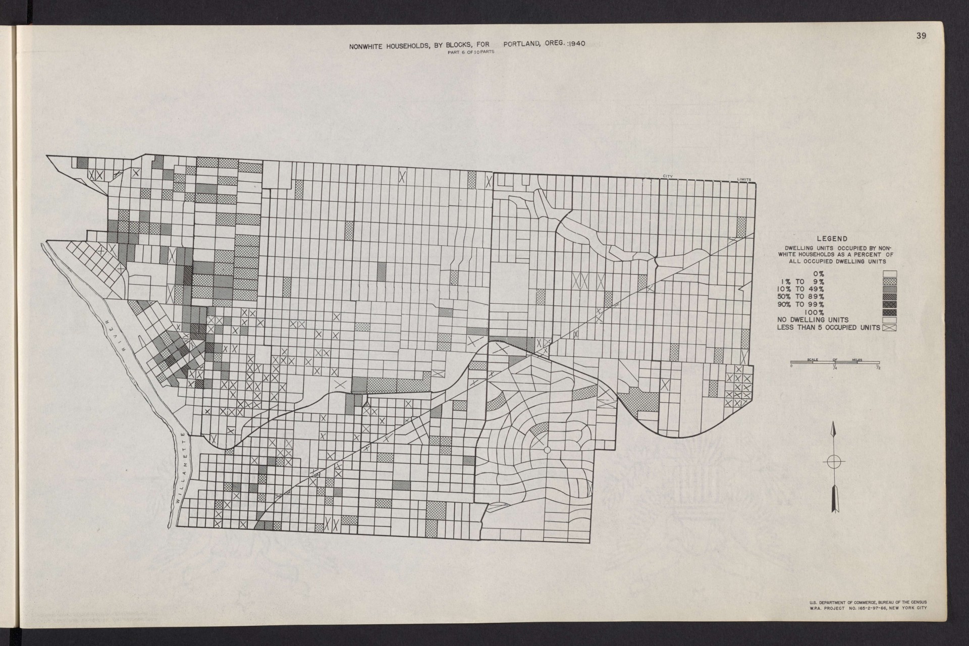
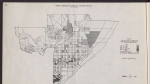
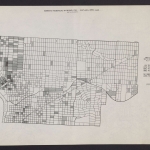
Map from a 1943 report, showing the density of Portland's non-white population, according to data from the 1940 U.S. Census. The map focuses on inner Northeast and Southeast Portland, from the Willamette River to about 65th Ave., and south from NE Fremont St. to roughly SE Stark St. The Irvington, Eliot and Lloyd neighborhoods (on the west end of this map) had Portland's largest concentration of African American residents at the time. The area of diagonal streets near the east end of the Broadway Bridge, which shows a high concentration of nonwhite households on this map, is where Memorial Coliseum was built in about 1960.
Download Files
Related content
Collections with this item
Details
Transcription
Contributors
Digital Publisher
Subject.Topic
Subject.Place
Language
Rights & Usage
Public domain (this work is believed to be free of known restrictions under copyright law).
Identifier
- XXmap_000176
Type
Date.Range
Format.Original
File format
Shelf.Location
- OREGON 331.83 U535shm 1940
Add new comment