Description
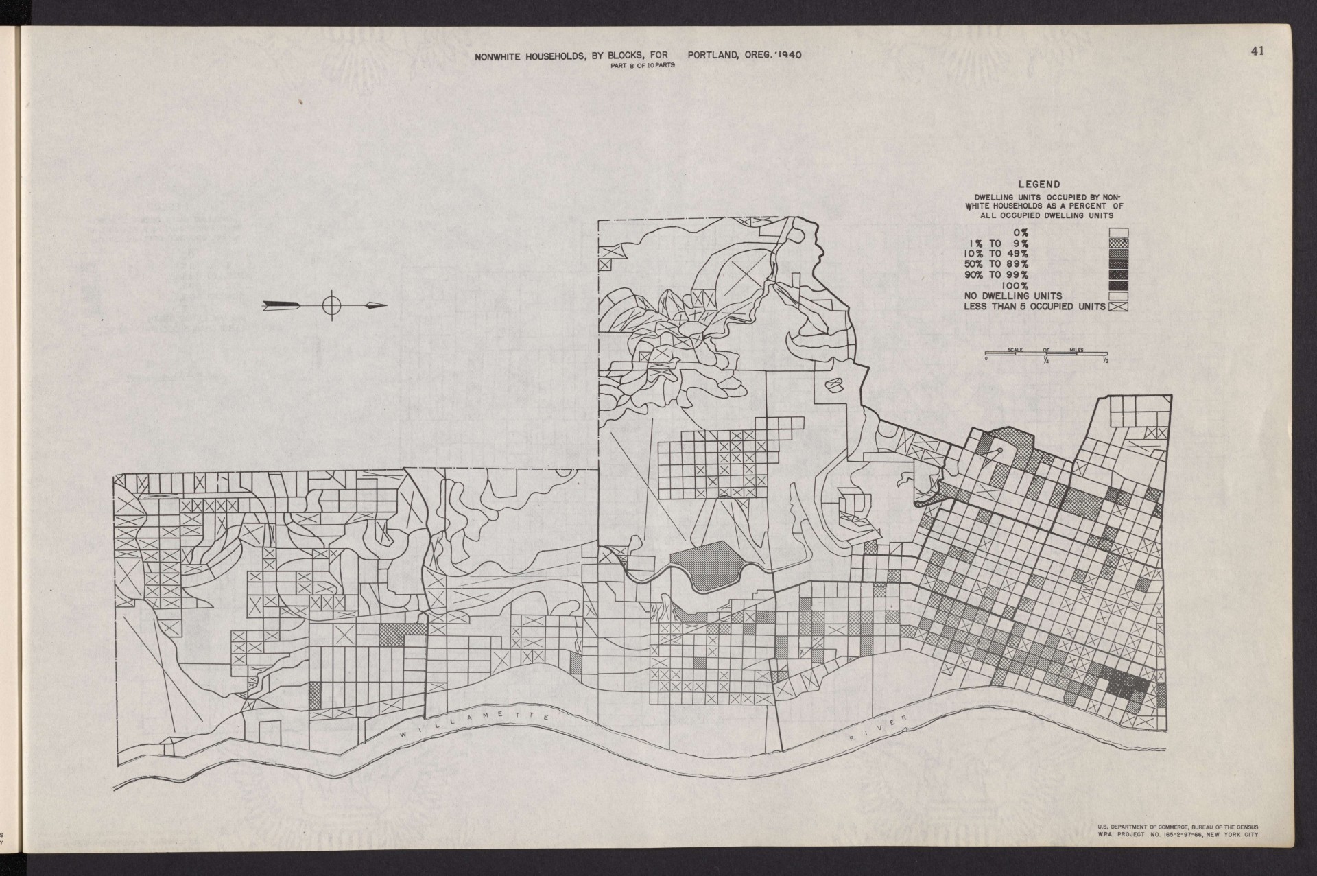
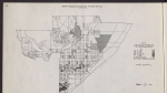
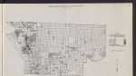
Map from a 1943 report, showing the density of Portland's non-white population, according to data from the 1940 U.S. Census. This map focuses on Southwest Portland, including downtown and the South Portland, Goose Hollow and Homestead neighborhoods. Portland's highest concentrations of Japanese American residents in this era were in downtown Portland (shown on this map), and in the Old Town-Chinatown neighborhood in inner Northwest.
Download Files
Related content
Collections with this item
Details
Transcription
Contributors
Digital Publisher
Subject.Topic
Subject.Place
Language
Rights & Usage
Public domain (this work is believed to be free of known restrictions under copyright law).
Identifier
- XXmap_000178
Type
Date.Range
Format.Original
File format
Shelf.Location
- OREGON 331.83 U535shm 1940
Add new comment