Description
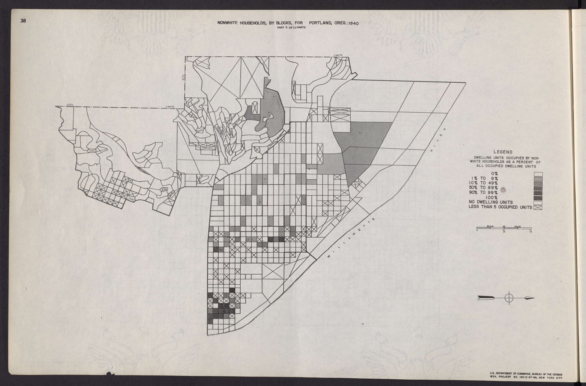
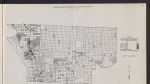
Map from a 1943 report, showing the density of Portland's non-white population, according to data from the 1940 U.S. census. The map focuses on Northwest Portland, and a little bit of Southwest Portland. The main area of the map is a triangle bounded by the Willamette River, W Burnside St. and what is now Forest Park. Portland's highest concentrations of Japanese American residents in this era were in the Old Town-Chinatown neighborhood (in inner Northwest, shown on this map) and in downtown Portland.
Download Files
Related content
Collections with this item
Details
Transcription
Contributors
Digital Publisher
Subject.Topic
Subject.Place
Language
Rights & Usage
Public domain (this work is believed to be free of known restrictions under copyright law).
Identifier
- XXmap_000175
Type
Date.Range
Format.Original
File format
Shelf.Location
- OREGON 331.83 U535shm 1940
Add new comment