Description
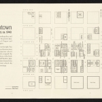
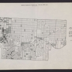
A set of five maps, dated June 1936, showing Portland's population by race/ethnicity. One panel illustrates the distribution of African American residents throughout the city, with the largest concentration of Black residents shown in the Eliot and Lloyd neighborhoods in inner North and Northeast. Another shows the distribution of Japanese American residents, with the largest concentration in downtown Portland and in the Old Town-Chinatown neighborhood in inner Northwest. Three other panels show population distribution for people classified as: foreign-born white; Chinese; and: Mexican, Indian [Native American] Filipino and all others. Visit City of Portland Archives for more https://efiles.portlandoregon.gov/record/16730
Collections with this item
Details
Digital Publisher
Subject.Topic
Subject.Place
Language
Rights & Usage
Rights undetermined (the copyright and related rights status of this work is unknown).
Identifier
- PUmap_000006
Type
Date.Range
Format.Original
File format
Shelf.Location
- A2012-006, M/10411


Add new comment