Description
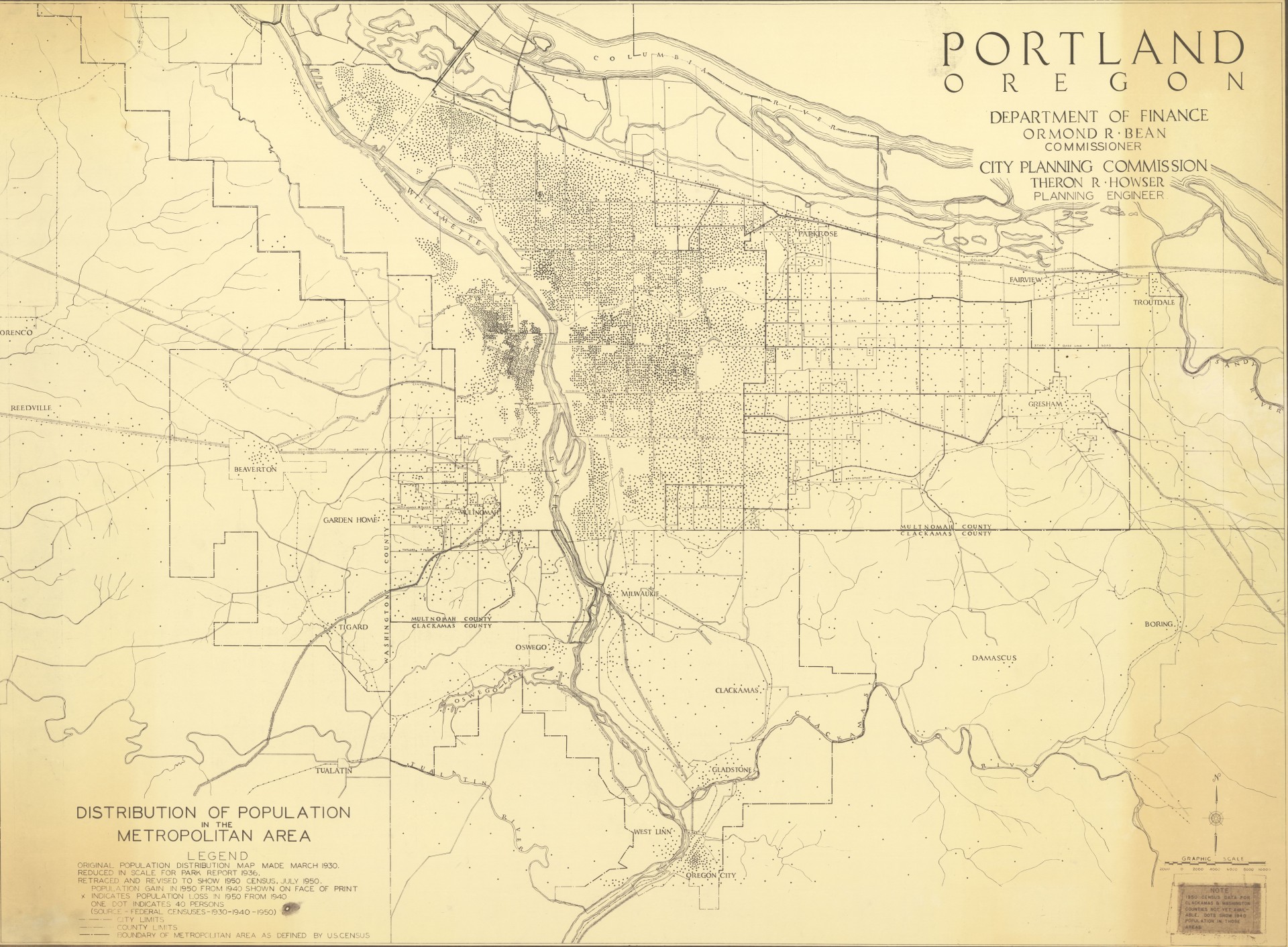
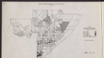
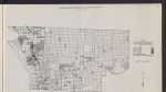
Map showing population of the Portland Metropolitan area. Data for Multnomah County is from the 1950 U.S. Census; data for Clackamas and Washington counties are from the 1940 U.S. Census. The map includes city and county limits, and also the boundary of the metropolitan area as defined by the U.S. Census Bureau.
Download Files
Related content
Collections with this item

Details
Digital Publisher
Subject.Topic
Subject.Place
Language
Rights & Usage
Rights undetermined (the copyright and related rights status of this work is unknown).
Identifier
- PUmap_000030
Add new comment