Description
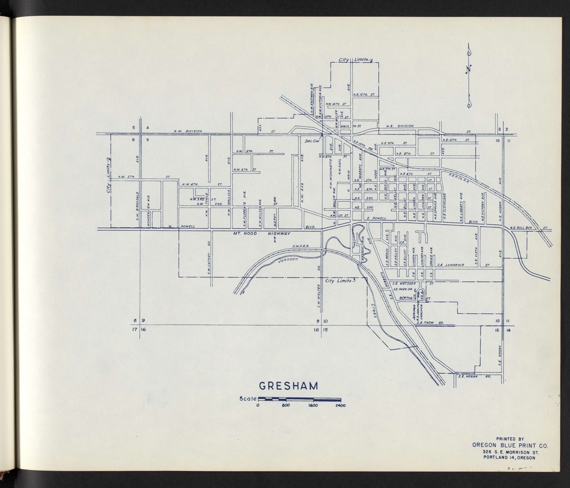
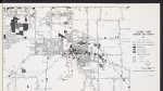
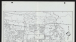
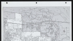
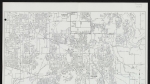
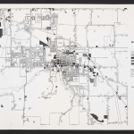
A map of Gresham, Oregon showing street names and city limits. Section lines and section numbers are noted on the map (the area covered in the map is all within Township 1 South, Range 3 East, Willamette Meridian). Johnson Creek is shown along the southern edge of the city. Two railroad lines are shown: P.E.P.Co.R.R. (Portland Electric Power Company) runs through downtown Gresham along N.E. 10th Dr., in roughly the same spot later occupied by TriMet's Blue Line MAX light rail. O.W.P.R.R. (Oregon Water Power & Railway Company) runs along Johnson Creek; this line has since been converted to a multi-use path called the Springwater Corridor. This map appears to show Gresham at some point before the 1960s.
Download Files
Related content
Collections with this item
Details
Transcription
Contributors
Digital Publisher
Subject.Topic
Subject.Place
Language
Rights & Usage
Rights undetermined (the copyright and related rights status of this work is unknown).
Identifier
- XXmap_000001
Type
Format.Original
File format
Shelf.Location
- OREGON 912.795 M29
Add new comment