Description
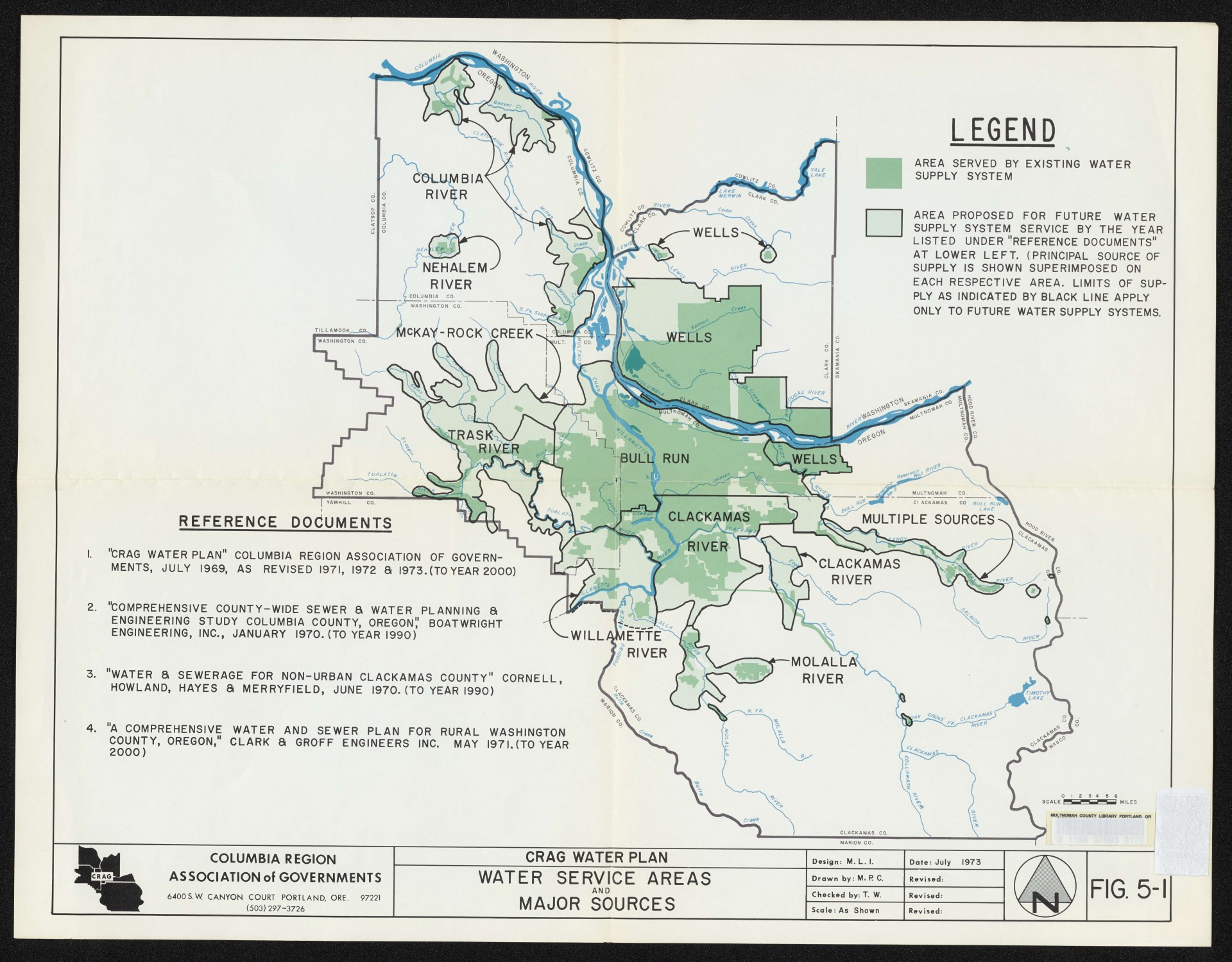
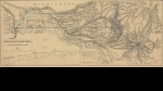
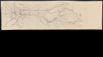
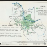
Map dated July 1973, showing existing and proposed water service, and major water supply sources in the Portland metropolitan area. The map covers Multnomah, Clackamas, Washington and Columbia counties in Oregon, and Clark County, Washington. The Columbia Region Association of Governments was a regional planning agency for these five counties. This regional planning role is now filled by Metro.
Download Files

Related content
Collections with this item
Details
Creator
Transcription
Contributors
Digital Publisher
Subject.Place
Language
Rights & Usage
Rights undetermined (the copyright and related rights status of this work is unknown).
Identifier
- XXmap_000046
Type
Date.Range
Format.Original
File format
Shelf.Location
- OREGON MAP 627.1 C726cw 1973
Add new comment