Description
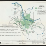
1957 map of Portland's water supply system, showing the boundaries of the Bull Run watershed and the Bull Run Reserve. The map also shows other water-related information: local water district boundaries, rivers, lakes and creeks. The city limits of Gresham and Portland are also indicated.
Download Files
Collections with this item
Details
Creator
Transcription
Contributors
Digital Publisher
Subject.Place
Language
Rights & Usage
Rights undetermined (the copyright and related rights status of this work is unknown).
Identifier
- XXmap_000021
Type
Date.Created
December 12, 1957
Date.Range
Format.Original
File format
Shelf.Location
- single map, bound in a folder labelled "Oregon water supply"


Add new comment