Description
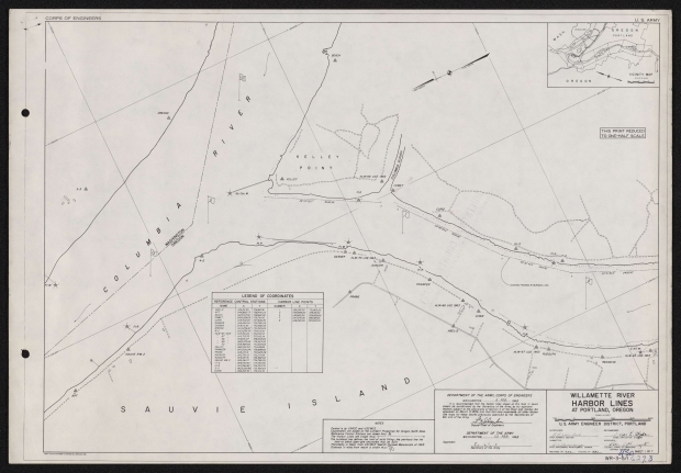
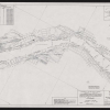
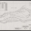
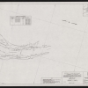
Set of seven charts of Portland harbor from the mouth of the Willamette at Kelly Point upriver to just south of the Sellwood bridge. Mile markers, harbor lines and navigational landmarks are shown on the chart. The chart has two dates: a submission date of February 9, 1968, and an approval date of February 23, 1968.
Download Files
Related content
Collections with this item
Details
Transcription
GENERAL PLAN OF MUNICIPAL DOCK NO. 1, FIFTEENTH STREET TERMINAL SHOWING ARRANGEMENT OF DOCKS AND WAREHOUSES,
TOGETHER WITH TRACK CONNECTIONS AND CARGO HANDLING FACILITIES.
CORPS OF ENGINEERS
U. S. ARMY
OREGON
VICINITY MAP
SCALE IN MILES
Q ' 2 Ï 4 1
y/^t
%
a
P%
Gp. Occ. W.
28*0552.7" 3042.59'
THIS PRINT REDUCED TO ONE-HALF SCALE
COMET
A"
to"
//
CUf1D_jf
A \
•v
Ff W.''^'
FIR
"F/ W.^ DASHER
HLM-70 USE 1963^ A DANCER
i
LEGEND OF COORDINATES
REFERENCE CONTROL STATIONS HARBOR LINE POINTS
NAME X Y NUMBER X Y
ABEL-2 1,416,151.35 728,8678! / 1,421,3/P 00 73/,865.00
APT 1,418,885.73 738,490.03 J 1,419,885.00 729,181.00
BEACH 1,423,74782 728,662.95 5 1,419,610.00 728,829.00
COMET /.420JD28O5 728,76145 7 1,417,270.00 726,92/OC
CUPID 1,418,902.43 727,946.76 9 /,4/6fi80.00 725,49500
DANCER 1,418,484.09 729,786.09
DASHER 1,419,116.83 730,582.08
DREDGE 1,424,258.87 733,229.08
4-2 1,420,636.14 734,005.6I
HLM-65 1963 1,413,341.24 724,496.9/
" 67 * 1,414,715.35 727,143.94
" 68 " I.4I6JS4I.07 728,358.88
" 69 " 1,420,372.64 728,923.22
" 70 ” 1,4/8,989.83 730,380.65
KELLEY 1,421,548.53 73/,245.60
PRANCER 1,417,509.24 728,896.62
PRANG 1,418,1/9.91 730,925.28
REDNOSE 1,413,750.12 725,7/789
RUDOLPH 1,414,537.31 726,882.52
SAUVIE RM 2 1,419,264.71 736,788.05
17-2 1,416,459.60 725,569.30
13-3 1,417,264.62 726,523.70
3-3 1,423,520.45 735,985.63
VIXEN 1,416,216.93 728,109.16
Ê&
PRANG
7*
PRANCER
***2
_____^fkg 7
' ¿/Sf J
23c3/‘36.4
2430.00
to
//
^ * "
H
u
RUDOLPH
EINTW\
HLM-65 USE 1963
%
REDNOSE
(I
NOTES
Control is by USACE and USC&GS.
Coordinates are based on the Lambert Projection for Oregon, North Zone. Reference Control Stations are shown thus: Â
The Harbor Lines are shown thus: O---------------------------------o
The bulkhead line defines the limit of solid fillinai the pierhead line the limit to which open-pile structures may be built.
Planimetry is taken from USCQGS Special Purpose Manuscripts of 1963. Distance in miles from mouth is shown thus:
DEPARTMENT OF THE ARMY, CORPS OF ENGINEERS
WASHINGTON,_______
It is recommended that the harbor Unes shown on this map in seven sheets be established by the Secretary of the Army, by his approval thereof, subject to the provisions of Section II of the River and Harbor Act approved on March 3,1699, and that this map supersede all other harbor Une maps for these shores previously approved by the Secretaries of War and of the Army.
DEPARTMENT OF THE ARMY
WASHINGTON._____Sft. 1963
Approved:
i
Secretary of the Army
a
il «
il a
il n
II //
II II /
II
WILLAMETTE RIVER
HARBOR LINES
AT PORTLAND, OREGON
SCALE IN PEET
3t
J5S
MOO
SUPERVISED:
/?/?
U.S. ARMY ENGINEER DISTRICT, PORTLAND
>*#< ^- *
CHIEF, PERMITS SECTION
submitted:
CHIEF, WATERWAYS ^II^Elii^CE^ BRANCH PREPARED BY= _BA32.__ CHECKED BY:
RECOMMENDED:
CHIEF, NAVIGATION DIvrfÒN APPROVED^
COLONEL, CORPS OF ENGINEERS .3
DISTRICT El
Mq-
SHEET I OF 7
WR-3-5/1 (
<2 7.3
CORPS OF ENGINEERS
'.<20,000 -
LEGEND OF COORDINATES
REFERENCE CONTROL STATIONS HARBOR LINE POINTS
NAME X Y NUMBER X Y
AGUA 1,413,911.97 7/2,862.53 2 1,4/3,600.64 7/9,148.12
BUTZEN 1,413,203.16 721,238.43 4 1,414,576.00 7/6,738.00
HLM-57 1963 1,417,96362 713,026.90 6 1,415,190.00 715,158.00
' 58 " I,4l6fì02.70 712,970.22 8 1,416,439.00 7/2,446.00
* 5b * 1,4/5,060.49 7I4.8Z3.T2 9 1,416,080.00 725,495.00
' 60 " 1,414,423.44 716624.76 /0 i,4/7,384.00 7/0,799.00
' 6/ " 1,4/6,235.20 7/7,549.52 // 1,415,110.00 723,267.00
" 62 " 1,415,402.41 719,216.02 /3 1,414,830.00 721,130.00
' 63 " 1,4/5,366.65 722,641.21 Î5 1,415,182.00 7/8,9/8.00
' 64 " 1,412,996.45 722,198.46 !7 1,415,906.00 717,129.00
" 65 " 1,413,341.24 724,496.9! !9 1,418,250.00 711,928.00
RAM 1,415,238.23 720,260.93
REDNOSE 1,413,750.12 725,7/7.89
17-2 1,416,459.60 725,569.30
ST NICK 1,4/3,279.08 724,125.96
TERMINAL 1,418,146.19 7/5,099.44
13-3 1,417,264.62 726,523.70
22-3 1,413,135.92 719,102.33
US. WEST TOWER 1,4/3,664.27 7/7,950.45
WILLAMET 1,413,006.49 7/5,038.48
-----^T
Ö R E 6 0 N
PORTLAND /
0 R E G 0 N
'•4,5.000 -
n'/
to
v* H r p 1 a a \M I 'i h i S m 1 a a
// 11 -H TIME OIL CO.
fiV
a 'i n
HLM-63 USE 1963
&
\\
\\0 A
T *
\\ RED NO SE
ASH GROVE LIME II AND II
PORTLAND CEMENT „ Ca «
,« ■' ?//
if
0*E'
5ON
ship*"1-:
plNt
COUP-
X '
HLM-6! USE 1963
VICINITY MAP
SCAtE m MILES
420,000 —
329‘
A4'
RAM
~ ás~'*íp~
HLM-62 USE 1963
A
to
350-57 29.6 2239.63
lEInt.W ^ ^ HLM-65 USE 1963
/ 0
ST NICK
V y
a/
HLM-64 USE 1963 a
Vi;
\VV
‘•4'0,000
'-4'5,000~
A WILLAMET
THIS PRINT REDUCED TO ONE-HALF SCALE
''4l0&00 -
Control is by USACE and USCSGS.
Coordinates are based on the Lambert Projection for Oregon, North Zone Reference Control Stations are shown thus: A
The Harbor Lines are shown thus: O-----------------------------------o
The bulkhead line defines the limit of solid filling; the pierhead line the limit to which open -pile structures may be built.
Planimetry is taken from USCSGS Special Purpose Manuscripts of 1963. Distance in miles from mouth is shown thus:
DEPARTMENT OF THE ARMY, CORPS OF ENGINEERS
WASHINGTON,________3_ ECB._ /96S
it is recommended that the harbor lines shown on this map in seven sheets be established by the Secretary of the Army, by his approval thereof, subject to the provisions of Section H of the River and Harbor Act approved on March 3,1699, and that this map supersede all other harbor line maps for these shores previously approved by the Secretaries of War and of the Army. >
________________
DeputyLChief of Engineers
Approved:
DEPARTMENT OF THE ARMY WASHINGTON,_______22-FEQ._ ¡96ß
Secretary of the Army
WILLAMETTE RIVER
HARBOR LINES
AT PORTLAND, OREGON
e .ALE IN FEET 500 __________1000
SUPERVISED:
U. S. ARMY ENGINEER DISTRICT, PORTLAND
RECOMMEND)
\ , ft
CHIEF, PERMITS SECTION
submitted:
CHIEF, WATERWAYS MAINTENANCE BRANCH
iO: /
.. CC°PS OF ENGINEERS ^
COLONEL, CC°PS OF ENGINEERS DISTRICT ENGINEER
WR-3 ^Í.0¿j73
CORPS OF ENGINEERS
\
\
\
\
LEGEND OF COORDINATES
REFERENCE CONTROL STATIONS HARBOR LINE POINTS
NAME X Y NUMBER X Y
CAPLES 1,424,718.66 706,32/77 8 /,4/6,439.00 7/2,446.00
DIKE 1,427,800.45 704,757.13 1 /O 1,417,384.00 7/0,799.00
HLM -47 1963 1,426,809.73 701,754.84 1 !2 1,417,651.00 7/0,390.00
48 " 1,425,315.53 702,932.34 ' 14 1,419,60771 707,908.69
49 " 1,425,497.71 705/98696 • /6 1,420,516.27 707,0/5.4/
50 " 1,424,366.28 703,848.46 1 18 1,421,413.00 706,2/8.00
51 " 1,425,137.73 705,99/33 ! /9 1,418,250.00 711,928.00
5IA " 1,421,062.11 705,94237 ' 20 1,424,334.00 704,468.00
52 " 1,421,728.08 707,567.99 ! 2/ ¡,419,811.00 709,252.00
53 " 1,419,160.78 708,307.96 22 Ì,425,756.OC 703,057.00
54 1,420,797.53 708,634.37 j 23 1,420,308.65 708,626.46
55 1,418,057.39 709,692.13 25 1,421,581.00 707,396.00
se : 1,4/9,444.28 7/0/628.33 ! 27 1,422,03/00 707,071.00
ST 1,4/7,963.62 7/3,026.90 j 29 1,424,970.00 705,325.00
JON 1,422,021.94 708,543.05 3/ 1,427,685.00 703,020.00
37 1,424,310.77 706,337/7 j
^7
'OREGON
PORTLAND
VICINITY MAP
SCALE IN HlwCS
OREGON
1
JOHNS
DIKE
CAPLES
HLM-5/ USE 1963
Um UNNTON PLYWOOD ASSOC.
f- A ^
l\ HLAhSsljSE 1963
PORTLAND LUMBER MILLS
T99.3Sr
PORTLAND MANUFACTURING CO.
0
Si
HLM-49 USE 1963
Ha/
- 30S° so’ist Er
IS 55S-0S
Combined Pierhead 8 Bulkhead Lines
3
P
307*01
08.5
1767.21
356150
310*19 51.0
ÎJ
3 0Ç?
A
HLM-53 USE
n" unarm
1 SEATTLE RB
-I
3EO"AOO„,.
A
3292.84' HLM-47 USE 1963
PCNNSALT CHEMICALS CORP
HLM-50 USE 1963
HLM-48JJSE 1963
THIS PRINT REDUCED TO ONE-HALF SCALE
■X.
NOTES
Control is by USACE and USCQGS.
Coordinates are based on the Lambert Projection for Oregon, North Zone. Reference Control Stations are shown thus: A
The Harbor Lines are shown thus: o---------------------------------o
The bulkhead line defines the limit of solid filling; the pierhead line the limit to which open-pile structures may be built.
Planimetry is taken from USC3GS Special Purpose Manuscripts of 1963. Distance in miles from mouth is shown thus:
DEPARTMENT OF THE ARMY, CORPS OF ENGINEERS
WASHINGTON,_______E^Æ-_ ¡gçQ
It is recommended that the harbor tines shown on this map in seven sheets be established by the Secretary of the Army, by his approval thereof, subject to the provisions of Section // of the River and Harbor Act approved on March 3,1899, and that this map supersede all other harbor Une maps for these shores previously approved by the Secretaries of War and of the Army.
DEPARTMENT OF THE ARMY
WASHINGTON,_____23__FEB_ igea
Approved:
Secretary of the Army
WILLAMETTE RIVER
HARBOR LINES
AT PORTLAND, OREGON
7
SCALE IN FEET
-4S
U.S. ARMY ENGINEER DISTRICT, PORTLAND
SUPERVISED:
CHEF, PERMITS SECTION
submitted:
RECOMMENDED: .
.. ¿■■jj/tvk..
CHIEF, NAVIGATION DIVISION APPROVED^^
COLONEL, CORPS OF ENGINEERS - J DISTRICT ENGINEER Ä
WR-3-5/3/S0 éïl, 3
CORPS OF ENGINEERS
LEGEND OF :00RDI NATES
REFERENCE CONTROL STATIONS HARBOR LINE POINTS
NAME X Y NUMBER X Y
CP MON. B 1,434,782.46 694,159.84 24 1,427,843.00 700,510.00
CP MON. C 1,430,817.48 696,365.59 26 i,429,640.00 698,6/2.00
CP MON. 0 1,429,780.13 696,942.67 28 1,431,132.00 697,19300
C.P.MON. E 1,428,92727 697,417.12 30 1,435,600.00 694,467.00
COLUMBIA 1,430,696.14 702,176.02 32 1,436,714.00 693,907.00
HLM-35 1963 1,438,359.43 694,302.85 33 1,429,096.00 701,956.00
" 36 " 1,438,034.96 695,051.12 34 1,437,695.00 692,980.00
" 37 “ 1,436,30791 696,63728 35 1,429,829.00 701,615.00
" 37A " 1,436,156.14 698,381.96 37 1,430,331.00 701,658.00
" 38 " 1,435,188.49 694,554.15 39 1,431,209.00 701,962.00
" 39 " 1,433,878.62 697,465.70 41 1,431,718.00 701,813.00
" 39A " 1,435,372.79 697,87731 43 1,435,603.00 698,62/00
' 40 " 1,430,970.16 696,903.85 45 1,436,258.00 697,832.00
" 41 " 1,431,293.57 699,664.46 47 1,436,890.00 697,059.00
" 42 " 1,428,636.03 698,963.43 4* 1,436,688.18 697,068.80
" 43 " 1,436,36766 697,039.20 5/ 1,433,524.35 699,645.23
" 43A " 1,431,701.89 701,088.21 53 1,433,32562 69978/27
" 44 " 1,431,239.80 702/?92.85 55 1,431,705.00 701,10/00
" 44A " 1,430,87280 701,310.34 57 1,430,899.00 70/332.00
" 45 " 1,430,196.87 701,774.60 59 1,430,241.00 701,168.00
" 46 " 1,429,06770 702,200.47 61 1,429,682.91- 700,539.65
OVERLOOK 1,440,991.02 693,452.88 63 1,431,538.00 698,892.00
SCOTT 1,427,574.20 696,832.82 65 1,434,29500 696,889.00
UP 1,439,233.60 693,025.74 67 1,436,329.16 695,662.12
WALL 1,433,509.16 703,6/5.49 69 1,437,860.00 694,926.00
7/ 1,438,715.00 693,427.00
U. S. ARMY
"T"
Z"
■%
WALL
UNION PACIFIC RR.
/
3
\\t
a
HLM-44 USE 1963
CJ
1
« \ « V \ s \ %% \
uf A
COLUMBIA
v». I
----ZT
'OREGON
PORTLAND /
VICINITY MAP
SCALE IN MILES
y
J)
309'2*
12+233S3 /2*0.93
J S'
02°96'AS0^
20206
!29’09¿262_
4080.17
%*. "
,5C3
i?9° 09 26.2
HLM•
Occ.R.
1767.21
HLM-39A USB 1963
HLM-43 USE 1963 y
S' J
HLM-37 USe 1963 , Â
overlook
/ \\ \
HLM-4/ L/5f /96J
"Â"
^■Sî.
3*e’0*V6^aU\Î^!‘ -
•**WÛÎ
k1
1.
V 3b 38.9" 2481.15
305
5956-2
~3407.79
R]
-i.*0* 40'081“
0 O
3292.8+
r "ir~
i r
l L
Hr a i /
0
3/3° 22'43.5 1349.70
.7 1*3
Combined Pierhead 9 Bulkhead Lines
3/6° 33'56.7" 26/3.74'
DOUGLAS 0/L
A
HLM-42 USE !963
' &■“““
SHAVER
TRANSPORTATION
CO.
n C3 0 O
□
M / /V
ir
TERMINAL /
rf\
/
cf; Afo/u c
A
Cf? AÍC/V. D
A
Cf f/O/V. £
V
THIS PRINT REDUCED TO ONE-HALF SCALE
Nores
Control Is by USACe and USCBGS.
Coordinates are based on the Lambert Projection for Oregon, North Zone. Reference Control Stations are shown thus: A
The Harbor Lines are shown thus: o------------------------- o
The bulkhead line defines the limit of solid Piling; the pierhead line the limit to which open-pile structures may be built.
Planimetry is taken from USCGGS Special Purpose Manuscripts of 1963. Distance in miles from mouth is shown thus:
DEPARTMENT OF THE ARMY, CORPS OF ENGINEERS
WASHINGTON,_______Û1963
it is recommended that the harbor lines shown on this map in seven sheets be established by the Secretary of the Army, by his approval thereof, subject to the provisions of Section ii of the River and Harbor Act approved on March 3,1699, and that this map supersede oil other harbor tine maps for these shores previously approved by the Secretaries of War and of the Army.
DEPARTMENT OF THE ARMY
WASHINGTON,_____?.3_FE8. ,gea
Approved:
Secretary of the Army
WILLAMETTE RIVER
HARBOR LINES
AT PORTLAND, OREGON
SCALE IN FEET 500_____________1000
1500
U. S. ARMY ENGINEER DISTRICT, PORTLAND
ISEDi RE
A; A' _______
SUPERVISED^
CHIEF, PERMITS SECTION SUBMITTED:
CHIEF, WATERWAYS MAINTENANCE BRANCH
)VED^_
IEL, CORPS OF ENGINEERS D
COLONEL,
DISTRICT ENGINEER
WR-3-5/4
HLM-28 USE 1963
1 SWrr^A
LOUIS DREYFUS CORP.-
13/0.45
1208.47
UNION PACIFIC R. R. YARDS
fií/wQ.
HLM-
CORPS OF ENGINEERS
LEGEND OF COORDINATES
REFERENCE CONTROL STATIONS HARBOR LINE POINTS
NAME X Y NUMBER X Y
BURN 1,444,358.46 €84026.7f 36 1,439,26900 690,992.00
FEDERAL 1,441^34605 681,939.44 38 1,440,660.00 689,49900
GENE 1,443,579.76 678,611.31 40 /,442,548.00 687,67/00
HLM—22 1963 1,443,179.04 680,163.66 42 1,443,52500 686,635.00
“ 23 " 1,444,502.61 680,661.26 44 1,443,835.00 686,27700
" 24 * 1,443,626.50 682,025.86 46 /,444,125.00 685,740.00
" 25 " 1,444,998.99 682,887.80 48 1,444,247.00 685,4/2.00
" 26 " 1,444,160.12 685,6/9./3 50 1,444,325.00 685,005.00
" 27 " 1,443,754.37 686,025.0/ 52 1,444,397.00 684,352.00
28 " 1,444,285.44 686,882.7/ 54 1,444,362.00 683,986.00
29 " I,443fì7l.34 686,9/5.83 56 1,444,286.00 683,645.00
30 " 1,443,7/1.35 687,907.8/ 58 1,444,210.00 683,395.00
" 30A " 1,442,133.15 687,724.17 60 /,443,702.00 682,2/0.00
" 31 " 1,442,970.48 689,240.48 62 1,443,422.00 681,475.00
" 32 " 1,441,680.33 689,959.95 64 1,443,27000 680,962.00
" 33 " 1,440,522.45 689,455.32 66 1,443,258.00 680,698.00
34 " 1,439,025.99 691,128.60 68 1,443,338.00 679,807.00
MAR 1,443,293.50 681,043.86 73 /,44/,084.00 690,387.00
OVERLOOK 1,440,991.02 693,452.88 75 1,442,693.00 689,049.00
PORT. UN. DEPOT 1,442,558.56 686,481.85 77 1,443,373.00 688,050.00
STEEL 1,445,024.88 686,178.86 79 1,444,040.00 686,922.00
U.P. 1,439,233.60 693,025.74 8/ 1,445,191.00 685,597.00
WEATHERLY 1,446,607.98 682,038.42 83 1,445,299.00 684,500.00
85 1,444,994.00 683,465.00
87 1,444,44200 680,6/700
89 1,444,935.00 678,533.00
OVERLOOK
A
HLM-30 USE 1963
A
S "___LfiPSrSSL
xV" í» 7<r
VICINITY MAP
- Combined Pierhead 3 Bu/khejJ Unes
339°35 50f 33H 37'45.5" Lgl /349.95'
_ 6,P-30' ^ 1 çj a I 349*09037
___JN44Ï
u HLM-2F USE H63
WEATHERLY
- HLM-27 USE 1963/
A <
1 USE 1963
\HLM-29 USE 1963
A^
^PORTLAND UNION DEPOT/ CL0C/T TOWER -*jf
)>:\ ya 7as5j'
' HLM-24 USE 1963
A
FEDERAL
THIS PRINT REDUCED TO ONE-HALF SCALE
NOTES
Control Is by USACE and USC3GS.
Coordinates are based on the Lambert Projection for Oregon, North Zone. Reference Control Stations are shown thus: A
The Harbor Lines are shown thus: o-------------------------------o
The bulkhead line defines the limit of solid filling; the pierhead line the limit to which open-pile structures may be built Planimetry is taken from USCSGS Special Purpose Manuscripts of 1963. Distance in miles from mouth is shown thus:
DEPARTMENT OF THE ARMY, CORPS OF ENGINEERS
WASHINGTON,________& fEB._ /96&
It is recommended that the harbor lines shown on this map in seven sheets be established by the Secretary of the Army, by his approval thereof, subject to the provisions of Section II of the River and Harbor Act approved on March 3,1899, and that this map supersede all other harbor Une maps for these shores previously approved by the Secretaries of War and of the Army.
■ _____________________
WILLAMETTE RIVER
HARBOR LINES
AT PORTLAND, OREGON
ores previously c
Approved:
Deputy Chief of Engineers
DEPARTMENT OF THE ARMY WASHINGTON,__________2A -FEB._ /ggg
l"' v >_______________________
Secretary of the Army
U. S. ARMY ENGINEER DISTRICT, PORTLAND
SUPERVISED:
WR-3-5/5I
CORPS OF ENGINEERS
U. S. ARMY
LEGEND OF COORDINATES
REFERENCE CONTROL STATIONS
HARBOR LINE POINTS
NAME X Y NUMBER X Y
BRIDGE 1,445036.32 676,309.11 62 1,443,422.00 681,475.00
CENTER 1,447,026.18 673638.49 64 1,443,270.00 680,962.00
federal 1,441,346.05 681,939.44 66 1,443,258.00 680,698.00
GENE 1,443,579.76 678,611.31 68 1,443,338.00 679,807.00
HLM-6 1963 1,445,524.03 666,332.12 70 1,444,464.00 676,762.00
6A " 1,445615.38 667,821.38 72 ¡,444,650.00 676,098.00
" 7 " 1,443,184.70 669,193.87 74 1,444,7/9.00 675,315.00
* 8 " 1,444,302.89 669,383.80 76 1,44460500 674,542.00
9 " 1,443J006.64 671,031.47 78 1,444,36560 673,788.00
* 10 " 1,444,438.77 671,63368 80 1,443,390.00 671,139.00
// " 1,444/36.79 672662.38 82 1,443,365.00 670,000.00
/2 « !,444ß24.83 673,417.00 84 1,443,649.00 668,475.00
- 13 " 1,445,26504 674,540.78 86 1,444,378.00 666,929.00
" I3A " 1,445661.18 675,47!. 19 87 ¡,444,442.00 680,6/7.00
14 * .,444,326.97. 675,101.49 89 1,444,935.00 678,533.00
" 15 " 1,447,78807 669,354.27 9/ 1,445,871.00 676,590.00
" ISA “ 1,446,886.01 667,418.44 93 1,445,507.00 676,270.00
" I5B " 1,447079.68 668,703.32 95 1,445,255.00 675,669.00
16 1,448,173.60 670617.59 97 i,444,970.00 673,755.00
I6A 1,448,193.09 671,510.11 99 1,444,527.00 672,641.00
. )7 1,447,321.19 672,399.4! 101 1,444,242.00 671,378.00
‘ 18 " 1,446,414.66 672,624.7I 103 1,444,077.00 670,087.00
19 " 1,446,829.21 673,1/4.23 105 1,444,260.00 668,900.00
" I9A " 1,446,624.53 674,133.69 107 1,445,475.00 667,160.00
" 20 " 1,444,487.83 676.238.39 K)9 i,446,660.00 668,000.00
" 21 " 1,445,423.69 678,390.17 III Ì,447,079.68 668,703.32
“ 22 " 1,443,179.04 680,163.66 113 ¡,447,767.00 670,378.00
“ 23 " 1,444,502.61 680661.26 115 1,447,848.00 671,102.00
MAR 1,443,293.50 681,043.86 117 1,447,662.00 671081.00
119 1,446,4/4.66 672,624,71
121 1,445,780.00 674,374.00
123 1,445,721.00 675,60100
125 1,446,571.00 673,647.00
127 1,446,830.00 672,848.00
129 1,447,084.00 672,458.00
131 1,448030.00 671,738.00
133 1,448,184.00 671,245.00
135 1,448,090.00 670,293.00
137 1,447,073.00 667,804.00
139 ¡,446,600.00 667,313.00
141 1,445.271.00 666,479.00
TRUE NORTH
1----ST-
REGO N
PORTLAND
VICINITY MAP
SCALE IN MILES
OREGON
HLM-/6A USE !9€3
nr
HLM-17 USE 1963
HLM-/6 USE 1963
A
a3 05’38'20.7‘ 9se.es- I
516 .fl*i 135
Vz*39 .• "S
* - --------
HLM-15 USE 1963
CENTER
'Â û
HLM-/9 USE 1963¿/¿'fi; Æ°
M.
Ü
□
m
□
' HLM-Ì9A USE 1963
-, ' A"f
... .
HLM-/B USE /
J A
HLM-/3A USE 1963
<^X
üSf /3SJ
A
HLM-ISA USE 1963
'A
HLM-6A USE 1963.
U-20 USE 1963
rA<*
« ,^>6T‘S02' 78Si2-r9-?-i**l7' 781 tc- 76
HLM-/I USE 1963
, A
N
HLM-/0 USE 1963
A
Rj
\\v*>
f % sy
• » V
107
/y/.*-* ¿/5£
7=3^ Arn!
I HLM-/4 USE 1963
til
V/'f Cf41>==
.11
HLM-8 USE 1963
Ia
h
. I
__% ____
==_=^-==—=^
/r^
FEDERAL
* U* HLM-/2 USE 1963
m
"OO.f
Combined Pierhead 3 Bulkhead Lines
05° 27'327"
2606.82'
1301.50'
OP15 266 U39.27
' a/
HLM-9 USE 1963 /
I o L_n^
B. P. JOHN FURNITURE C
THIS PRINT REDUCED TO ONE-HALF SCALE
— X 1,440,000 -
NOTES
Control is by USACE and USC8GS.
Coordinates are based on the Lambert Projection for Oregon, North Zone. Reference Control Stations are shown thus: A
The Harbor Lines are shown thus: o--------------------------------o
The bulkhead line defines the limit of solid filling -, the pierhead line the limit to which open‘pile structures may be built.
Planimetry Is taken from USC3GS Special Purpose Manuscripts of 1963. Distance in miles from mouth is shown thus:
DEPARTMENT OF THE ARMY, CORPS OF ENGINEERS
WASHINGTON,________1968
it is recommended that the harbor lines shown on this map in seven sheets be established by the Secretary of the Army, by his approval thereof, subject to the provisions of Section U of the River and Harbor Act approved on March 3,1899, and that this map supersede all other harbor Une maps for these shores previously approved by the Secretaries of War and of the Army.
DEPARTMENT OF THE ARMY WASHINGTON,_______ëë- Eë§- 1968
Approved:
Secretory of the Army
WILLAMETTE RIVER
HARBOR LINES
AT PORTLAND, OREGON
SCALE IN FEET 500 ____________1000
supervised:
U. S. ARMY ENGINEER DISTRICT, PORTLAND
>eo:
CHIEF, PERMITS SECTION
submitted:
MENÓED: &
CHIEF, NAVIGATION ^VISION
CHIEF, WATERWAYS MAINTENANCE BRANCH
COLONEL, CORPS OF ENGINEERS
DISTRICT ENGINEER _______________ _
W.AdF SHEET 6 OF 7
WR-3-5/6
WR-3-5/7^50 ¿2 7.3
Portland harbor
WILLAMETTE RIVER
mjm-,
L8R0>
COUNT) ROCK
imHA&L
pom
US.Gov "fi w uto on ma
wajm&L
THE COMMISSION OF PUBLIC DOCKS
PORTLAND OREGON
t/K'rriro
OM/jfftMN-
Vorti/cjpcn
UNION \ OIL CO
mdus\
ko/vn
ncw Municipal f-PE-iqiiT
<£ <?P/riN TtßMIUAL
PC MUSO LA LUMB£R CO.
POKTCMWiSN
SCALE MILES [
NOfiTH+POC/ffC
\UJMBCfíCO.
it am
POffn/wD
inOUNtNO
Tunnel-
DRY DOCKS, PORTLAND HARBOR
LIST OF PRINCIPAL DOCKS, PORTLAND, OREGON, FOR RIVER SHIPPING.
Harbor Frontage of Dock, Lin. Ft.
200 410 2S0 200 200 200 250
LIST OF PRINCIPAL DOCKS, PORTLAND, OREGON, FOR OVER-SEAS AND COASTWISE SHIPPING.
Location indicated on map by
1 ............West Oregon Lumber Co.........
3 ............ Clark & Wilson Lumber Co....
6 ............Municipal Dock No. 3..........
7 ............ St. Johns Lumber Co..........
11 ...'......... Peninsula Lumber Co...........
12 ............. Portland Flouring Mills Co....
13 ........ Oregon-Washington Dock.............
14 .............North Pacific Lumber Co......
15 ............. Eastern & Western Lumber Co
16 .............Pacific Coast Elevator Co.....
17 .............Albina Dock................
19 .............Municipal Dock No. 1...........
20 ........... Spokane, Portland & Seattle...
21 ............. Montgomery Dock No. 2........
24 ............. Crown Mills .........
25 ............. Irving Dock .................
26 .............Mersey Dock................
27 ............ Columbia Dock No. 1..........
^28 ............. Albers Dock No. 3...........
28 ............ Albers Dock No. 2............
29 ............. Albers Deck No. 1.....
30 ............. Ainsworth Dock ..............
31 ............. Globe Milling & Elevator-Dock
32 .............. Couch St. Dock....... . • •
35 ............. Municipal Dock No. 2..........
36 ............. Oak St. Dock................ .
40 ............. Supples Dock ................
43 .. „......... Portland Lumber Co...........
44 ............. Inman-Poulsen Lumber Co.....
Dead Weight Liftilfc Capacity 10,000 Tons 3,500 Tens
Location indicated on map by
Location indicated on map by 32 34
37
38
39
41
42
Harbor Frontage of Dock, Lin. Ft. 370 580 540 550 1,000 560 580 650 650 560 570 1,440 1,000 550 300 410 300 300 270 175 300 900
260
526
200
190 .
450
450
Dock is used for shipments of
.............. Lumber1
............... Lumber1
.........General Cargo
................ Lumber
................ Lumber
................. Flour
..........General Cargo
............... Lumber.
................ Lumber
............... Grain
................ Grain
..........General Cargo
General Cargo and Grain
................. Gram
............... Flour
..................Grain
....... .General Cargo
.........General Cargo
..........General Cargo
..........General Cargo
..........General Cargo
..........General (Cargo
Name of Dry Dock
Port of Portland Dry Dock Oregon Dry Dock........
Located at foot of
........ Davis Street
.......... Ash Street
... Washington Street
........Alder Street
......Yamhill Street
........Taylor Street
..... Jefferson Street
Name of Dock
Allen & Lewis Dock.......
Ash St. Docks..........
Washington St. Docks....
Alder SL Docks.........
Yamhill St. Dock........
Taylor St. Dock.......
American Exchange Dock
Name of Dock.
LIST OF SHIPBUILDING PLANTS, PORTLAND HARBOR.
Location indicated on map by
45
46
Builds
...................Steel Vessels
...................Steel Vessels
...................Steel Vessels
..................Wooden Vessels
. . . . ..........Wooden Vessels
..................Wooden Vessels
......Wooden and Steel Vessels
Wooden Vessel^ and River Boats
..............7>.-^.River Boats
..................;.River Boats
..................Wooden Vessels
Name of Plant
Northwest Steel Co.............
Columbia River Ship Building Cj Albina Engine & Machine Work„ Peninsula Shipbuilding Co. .J** Columbia Engineering Worki ‘ * * Heath Shipbuilding Co... / ' ’ ’
Supple Shipbuilding Co.-./'....
Joseph Supple..................
Portland Shipbuilding '¿L.....
SL Johns Shipbuilding ........
John Kiernan Steamship Co
LIST OF FUEL OIL ANO COAL DOCKS, PORTLAND HARBOR
Harbor Frontage of Dock, Lin. Ft. 400 400 400
300 .
100 .
Location indicated on map by
9.__
Supplies
Name of Dock
Associated Oil Co.... Standard- Oil Co......
Union Oil Ca.......
Pacific Coast Coal Co Independent Coal Co.
General iCari ig General ,t%r|o General Cargo
......Cement
..... Lumber
..... Lumber
Extent
- 7 images
Digital Publisher
Subject.Topic
Subject.Place
Language
Rights & Usage
Public domain (this work is believed to be free of known restrictions under copyright law).
Identifier
- XXmap_000029
Type
Date.Range
Format.Original
File format
Shelf.Location
- Bound in a folder with Oregon harbor maps - fourth sheet



Add new comment