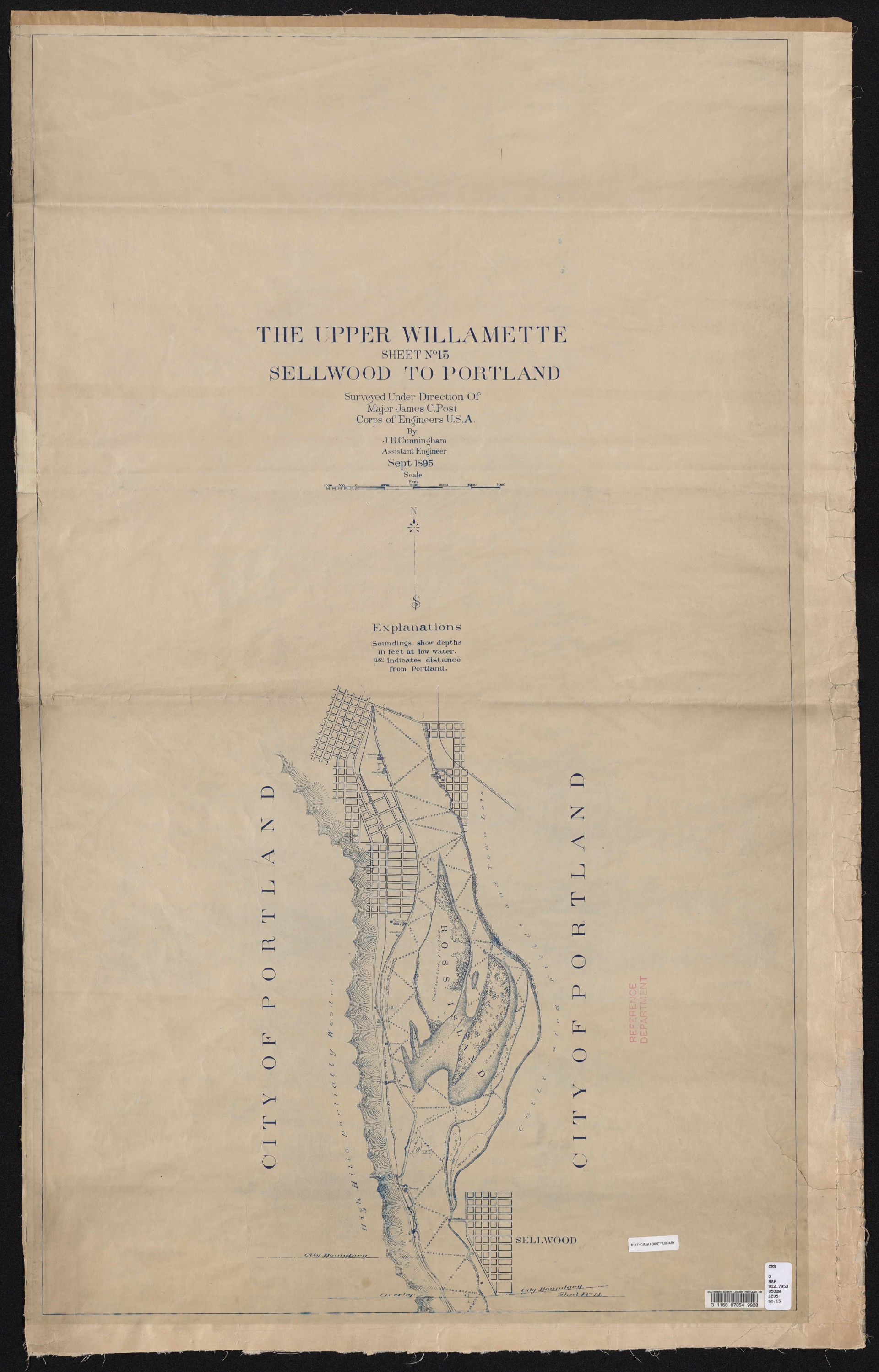
Description
Map dated September 1895, showing the Willamette River from Sellwood to Portland, with depth soundings, mile markers, and navigational obstacles (gravel, mud flats, etc.). River-side industries and railroad lines are illustrated. The Portland and Willamette Valley Railroad follows the west shore of the Willamette, and the Southern Pacific Railroad going through southeast Portland. At the northernmost extent of the map, the 1891 Madison Street Bridge is shown, precursor to the Hawthorne Bridge, which was built in 1910. This is the final chart in a series illustrating the Willamette River from Eugene to Portland.
Download Files
Related content
Collections with this item

Details
Creator
Transcription
Contributors
Digital Publisher
Subject.Topic
Subject.Place
Language
Rights & Usage
Public domain (this work is believed to be free of known restrictions under copyright law).
Identifier
- XXmap_000025
Type
Date.Range
Format.Original
File format
Shelf.Location
- OREGON MAP 912.7953 U58uw 1895 no.15
Add new comment