Description
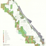
Base map of Forest Park, dated 1959. Map shows elevation, trails, fire lanes and roads within the park. A few campgrounds are also indicated. Visit City of Portland Archives for more https://efiles.portlandoregon.gov/Record/17345/
Collections with this item
Details
Contributors
Digital Publisher
Subject.Topic
Subject.Place
Language
Rights & Usage
Rights undetermined (the copyright and related rights status of this work is unknown).
Identifier
- PUmap_000013
Type
Date.Range
Format.Original
File format
Shelf.Location
- M/11026


Add new comment