Description
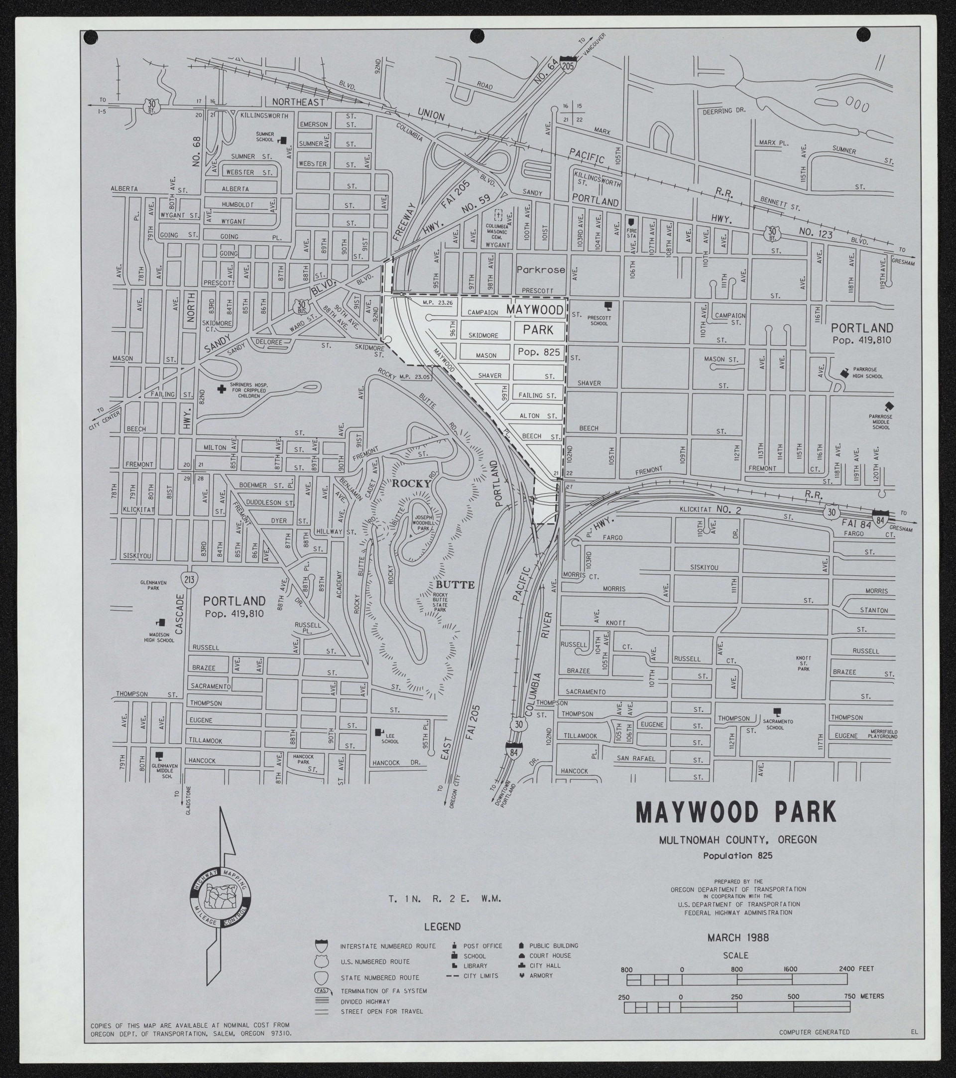
A map, dated March 1988, showing the small city of Maywood Park completely surrounded by the city of Portland, which had annexed neighboring areas in 1981. The map shows street names, section lines and section numbers. The map also shows two nearby freeways: Interstate 84 (also Highway 30) and Interstate 205. Rocky Butte appears to the southwest of the city.
Download Files
Related content
Collections with this item
Details
Creator
Digital Publisher
Subject.Topic
Subject.Place
Language
Rights & Usage
Rights undetermined (the copyright and related rights status of this work is unknown).
Identifier
- XXmap_000098
Type
Date.Range
Format.Original
File format
Shelf.Location
- OREGON 912.795 O653
Add new comment