Description
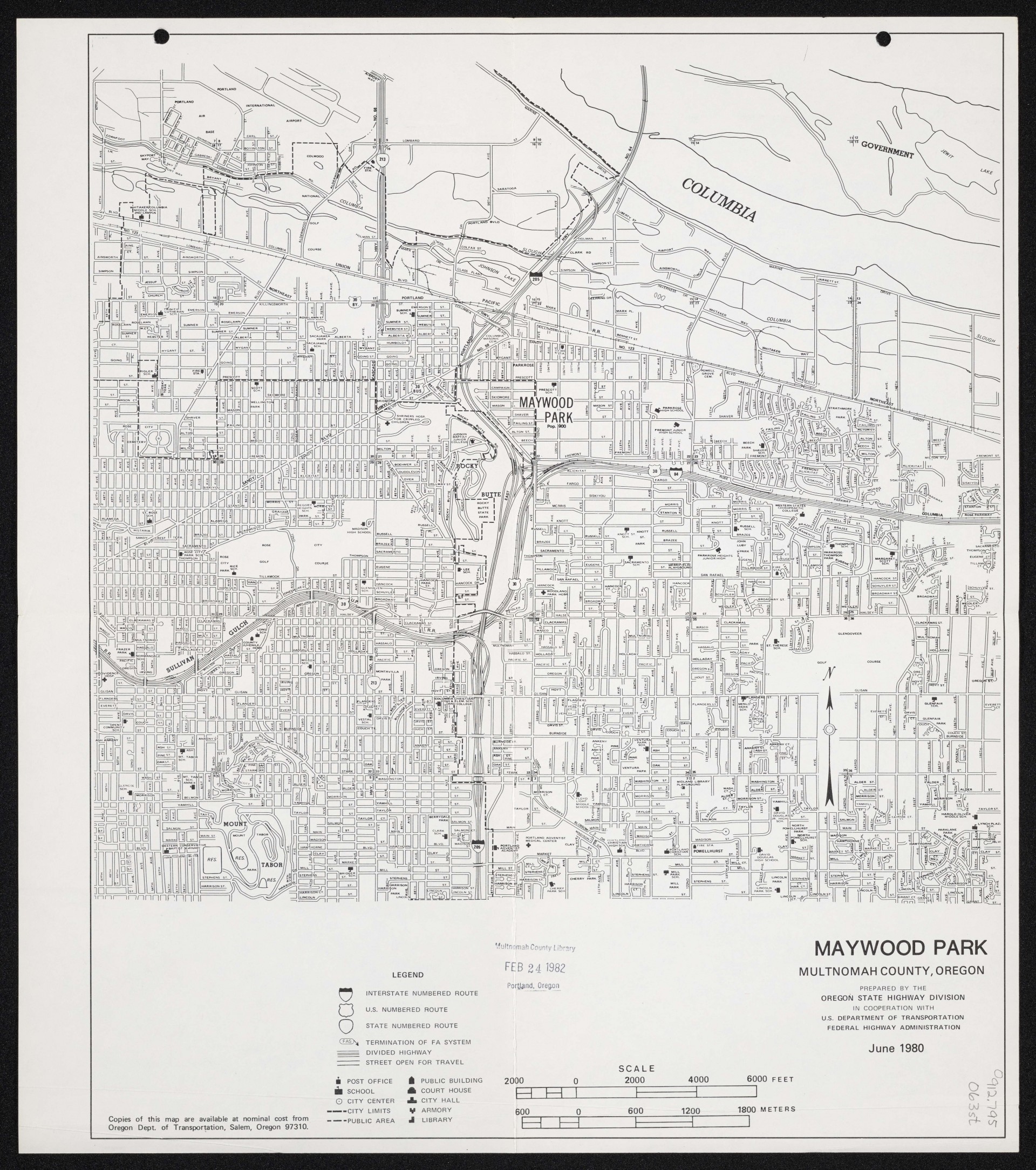
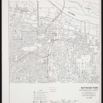
A map of Maywood Park, Oregon, dated June 1980. At this time, Maywood Park was a small city surrounded by unincorporated, though fairly urbanized, neighborhoods. (The following year, in 1981, the city of Portland expanded to completely surround Maywood Park.) Dashed lines indicate Maywood Park and Portland city limits. The map shows street names, section lines and section numbers. The map shows two nearby freeways: Interstate 84 (also Highway 30) and Interstate 205. Rocky Butte appears to the southwest of the city.
Download Files
Related content
Collections with this item
Details
Creator
Digital Publisher
Subject.Topic
Subject.Place
Language
Rights & Usage
Rights undetermined (the copyright and related rights status of this work is unknown).
Identifier
- XXmap_000057
Type
Date.Range
Format.Original
File format
Shelf.Location
- OREGON MAP 912.795 O63st apx. v. 3
Add new comment