Description
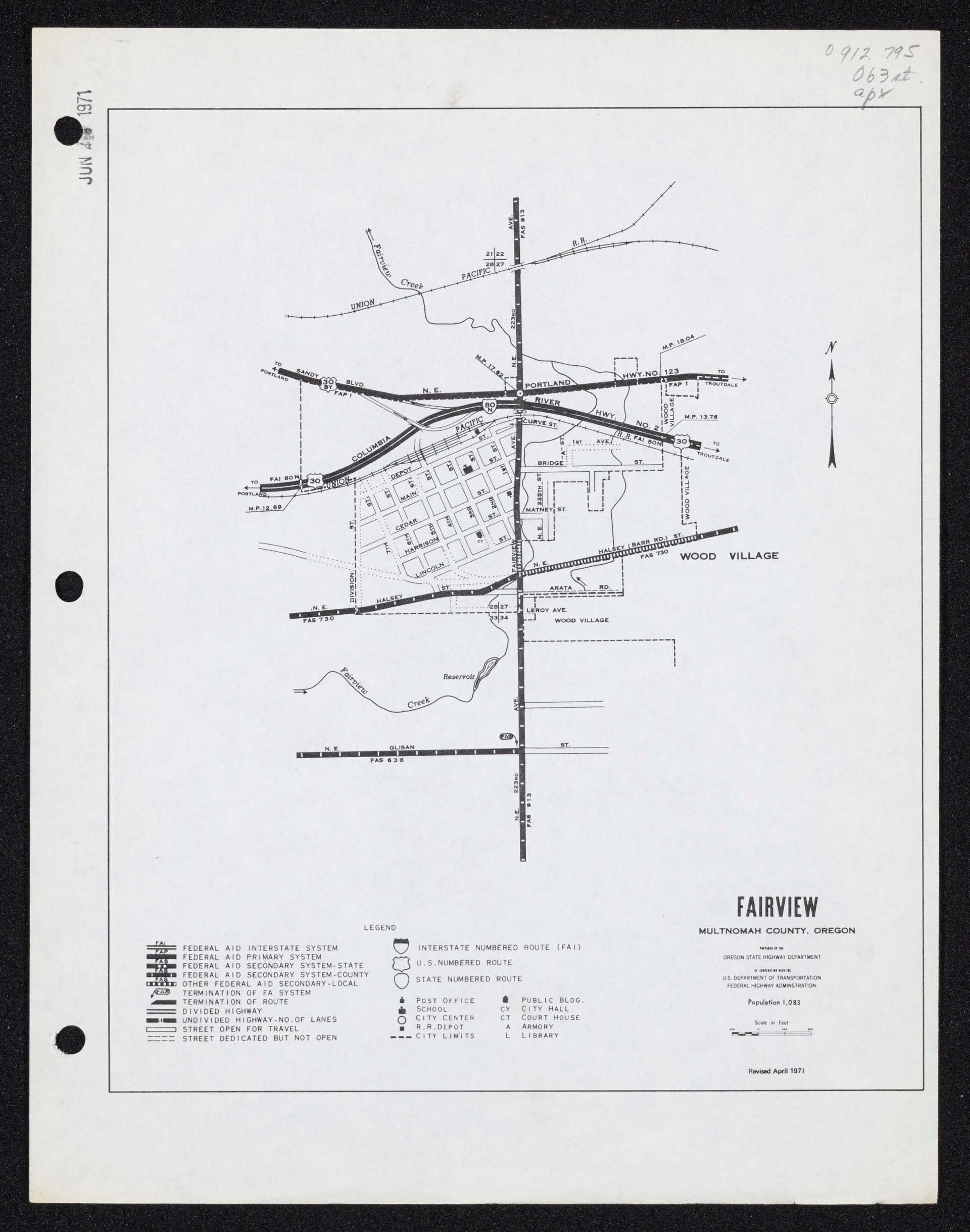
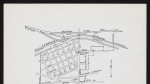
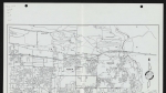
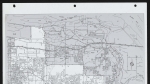
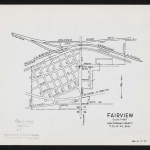
A map of Fairview, Oregon, dated April 1971. The map shows street names and city limits. Section lines and section numbers are also noted (the area covered in the map is all within Township 1 North, Range 3 East, Willamette Meridian). Fairview Creek and one of its tributaries is shown; the map also shows a reservoir on Fairview Creek, just south of city limits. Some public buildings are noted, as is the neighboring city of Wood Village. Two railroad lines, both marked Union Pacific R.R. run through the northern part of the map. Two major east-west roads are also shown. One is a freeway, marked Columbia River Hwy. No. 2 and designated with highway shields 30 and 80N. This freeway was later renumbered Interstate 84. The other major east-west road on the map is marked Sandy Blvd. N.E. and Portland Hwy. No. 123.
Download Files
Related content

Collections with this item
Details
Transcription
Digital Publisher
Subject.Topic
Subject.Place
Language
Rights & Usage
Rights undetermined (the copyright and related rights status of this work is unknown).
Identifier
- XXmap_000053
Type
Date.Range
Format.Original
File format
Shelf.Location
- OREGON MAP 912.795 O63st apx. v. 2
Add new comment