Description
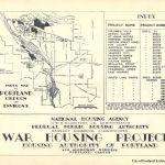
Map of the Columbia Slough, dated January 1922. The city of Vanport was built twenty years later, near Force Lake, between the Denver Avenue Approach to the Interstate Bridge and the railroad line. An additional development known as East Vanport was built just east of Denver Ave. The map shows Peninsula Drainage Canal, Switzler Lake, Sand Island, Columbia Beach, Mud Lake, Force Lake, Hayden Island, North Portland Harbor, Smith Lake, Blyth Lake, Ramsey Lake, Ramsey Island, Pearcy Island and the Willamette River. City limits are indicated on the map, as are some property owners' names. The Bridgeton subdivision is shown just south of Sand Island. The map records data describing the length of time it took a float to travel from the Columbia Drainage Canal, west to the Willamette River. Visit City of Portland Archives for more https://efiles.portlandoregon.gov/record/3910498
Collections with this item
Details
Contributors
Digital Publisher
Subject.Topic
Subject.Place
Language
Rights & Usage
Public domain (this work is believed to be free of known restrictions under copyright law).
Identifier
- PUmap_000004
Type
Date.Range
Format.Original
File format
Shelf.Location
- A2009-018, M/1769
Add new comment