Description
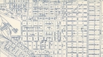
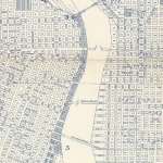
Undated map, used in planning for a city project to extend and enlarge SW Front Ave. Shaded areas along SW Front and Water Avenues indicate blocks where buildings were to be demolished to make way for the new highway. A handwritten note on the map states "Withhold building permits on shaded area." The highway that was eventually completed in 1942-1943 was named Harbor Drive. Visit City of Portland Archives for more https://efiles.portlandoregon.gov/record/4083129
Related content
Collections with this item
Details
Digital Publisher
Subject.Topic
Subject.Place
Language
Rights & Usage
Rights undetermined (the copyright and related rights status of this work is unknown).
Identifier
- PUmap_000024
Type
Date.Range
Format.Original
File format
Shelf.Location
- A2010-008, M/1837
Add new comment